Create Drone Maps
Pointscene offers the possibility to create orthophotos and surface models directly from drone photos online with photogrammetric processing. You can drag & drop the drone photos in and let Pointscene Web do the processing for you.
An RTK Drone is required to be used to get reliable results. Pointscene Drone Maps doesn’t support ground control points or check points. The processing doesn’t provide a report. Read here more about the accuracy of Pointscene Drone Maps.
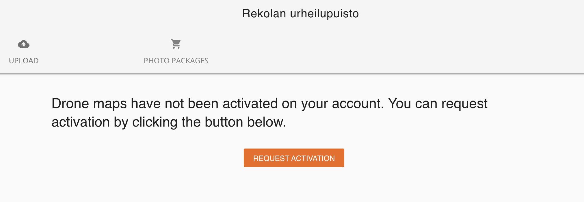
Request the activation of the tool from Sites > Options > Create Drone Maps > Request activation
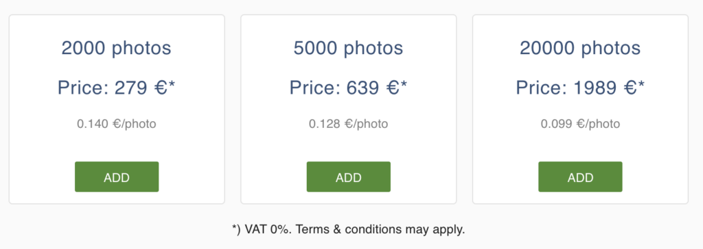
Purchase a photo package. The photos can be used on any project. The photo packages are for individual use, not for everyone on the project. A typical drone flight is about 500 photos.
Creating Orthophotos and DSM surfaces with Pointscene Drone Maps
- Open you site
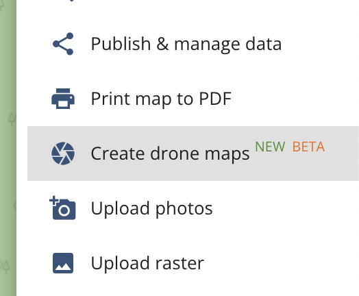
- Click on OPTIONS
- Click on Create Drone Maps
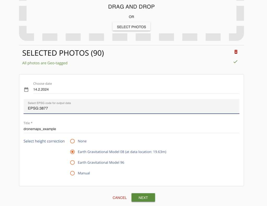
- Drag&Drop your photos (typically 500 photos takes about 2-3 hours)
- Provide the capture date
- Select an EPSG code
- Type in a name for the final data sets
- Select a global height correction or give a manual value
- If you don’t know what height correction is needed we recommend “Earth Gravitational Model 08”. Pointscene fetches the right correction at the location of your photos.
- Most users will likely use the “Manual” mode and get a more accurate correction from their local geoids in their country.
- Click on NEXT and UPLOAD
- Once the processing is ready (typically 2-3 hours for 500 photos) you will get an email notification
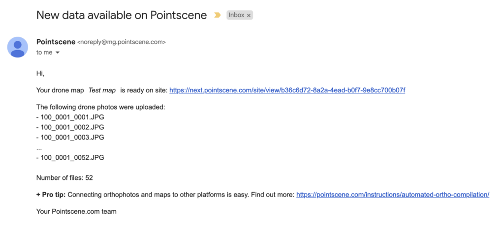
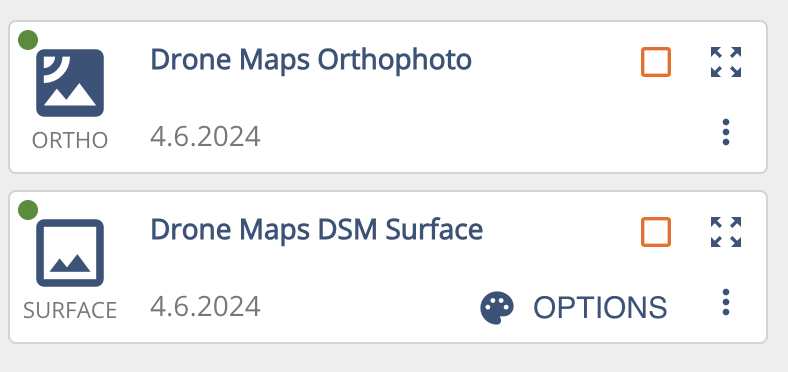
The results of the Drone Maps are 2 layers, an orthophoto and a DSM surface. They can used in the same way as any orthophoto or DSM.