
CREATE
Drone Maps
Pointscene Web is a tool for construction, BIM and survey professionals.
With our Drone Maps module you can create accurate and measurable drone orthophotos and surface models online with photogrammetry.
Our website is transitioning to ARKANCE.world. All local ARKANCE offices can help you with Pointscene and other Be.Smart software.
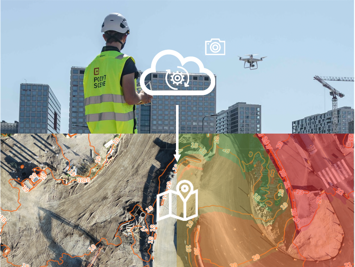

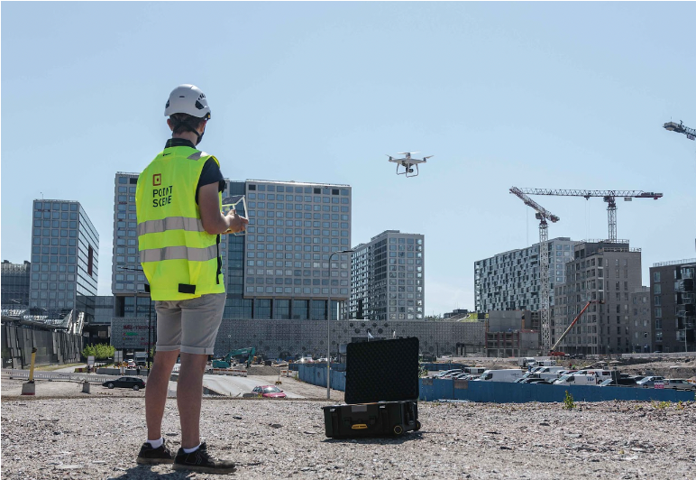
Collect & Process Data
- Use an RTK drone for high accuracy
- Drag & Drop photos to Pointscene
- Select coordinate system and height correction
- Upload
- Now you are free to do other work while waiting
- Processing takes typically 2 hours (500 photos)
Use data
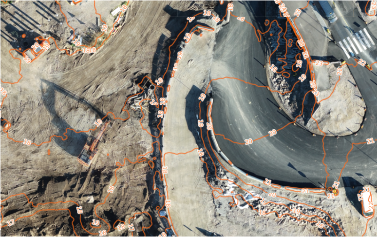
Find your ready-to-use orthophoto and surface model directly in your project.
Use for:
- Follow earthworks quantities
- Check height differences between two surfaces
- Calculate digging and blasting volumes
- Check space requirements for cranes or concrete trucks

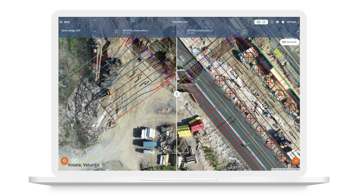
Share data
Use for:
- Share data without sending the original file
- Overlay orthophoto with plans and designs
- Share up-to-date views of your worksite
- Give data access to all stakeholders for different software
- Manage and store your drone data in the cloud
Packages
All our Pointscene users can purchase this photogrammetry module for use for any project. The packages are based on the amount of photos that need to be processed. A typical drone flight has about 500 photos.
The photo packages are for individual use. One user can process data for multiple site. Prices below.
Plans and pricing
2000 photos
279 €
Photos can be used by one user for multiple sites or flights. Requires a Pointscene Web license to operate.
VAT 0%. Terms & conditions may apply.
5000 photos
639 €
Photos can be used by one user for multiple sites or flights. Requires a Pointscene Web license to operate.
VAT 0%. Terms & conditions may apply.
20000 photos
1989 €
Photos can be used by one user for multiple sites or flights. Requires a Pointscene Web license to operate.
VAT 0%. Terms & conditions may apply.
Enterprise deal
100 000 photos or more. Photos can be used by one user for multiple sites or flights. Requires a Pointscene Web license to operate.
Contact sales for more details.
Contact us to get your photo package
More information about drones and Pointscene Drone Maps
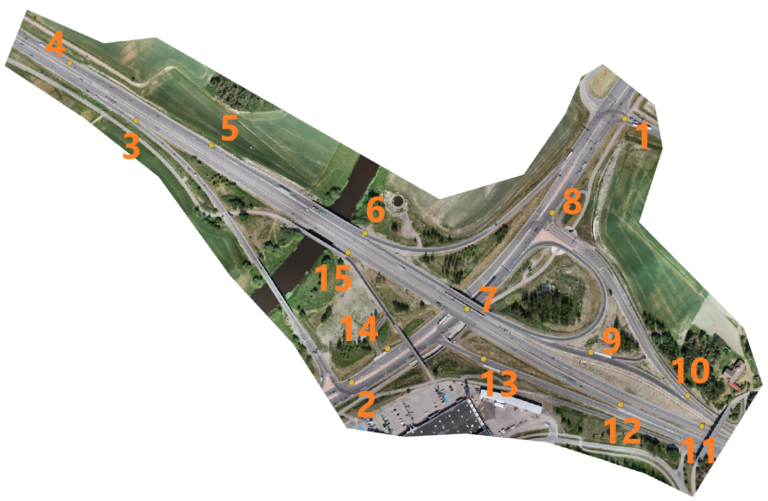
Comparative Analysis of Orthophoto Accuracy
The two orthophotos under study were generated from the same raw imagery captured by a drone equipped with RTK technology, which provides high-accuracy positioning.
Comparative Analysis of Orthophoto Accuracy: Pointscene Drone Maps
Customer Story
Fortum is our first customer using Pointscene Drone Maps. "With Pointscene we can easily monitor worksite quantities with our drone data." Milla Kivioja, Project Engineer
District Heating Network Project DC LTO by Fortum
Mapping with Drones: RTK vs. Traditional Methods
RTK stands for Real-Time Kinematics, a system that enhances GPS accuracy by correcting signal errors in real-time
Construction Site Mapping with Drones: RTK vs. Traditional Methods