
Check out our latest video about the subject:
Introduction
Drones with and without Real-Time Kinematic (RTK) technology help mapping and monitoring practices on construction sites. Drones offer a unique aerial perspective, making it easier to collect photos, videos, and precise map data of construction sites. However, the choice between using a drone with or without RTK can significantly impact the efficiency, safety, and accuracy of the data collection process.
The Basics of Drone Usage in Construction
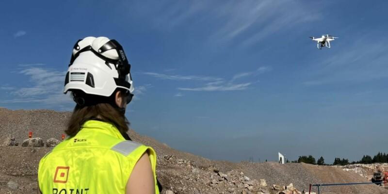
Drones have become an important tool in construction for various tasks, including collecting aerial photos and videos. These images provide situational awareness of the site and give perspective. Any market-available drone equipped with a camera can perform these tasks. However, when it comes to mapping construction sites for precise data collection, the choice of drone technology becomes crucial.
Remember to always follow local legal regulations for drone usage. Most drones require some sort of license to operate.
Ground Control Points vs. RTK Technology
Traditionally, mapping a construction site with a drone involves setting up several ground control points (GCPs). This process, while ensuring data preciseness, is time-consuming and labor-intensive. Each point must be placed and recorded by walking across the site, which can also pose safety risks in active construction areas.
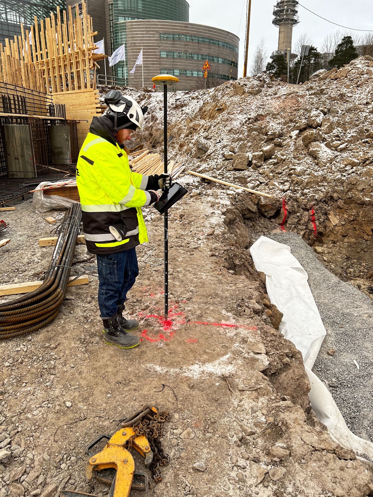
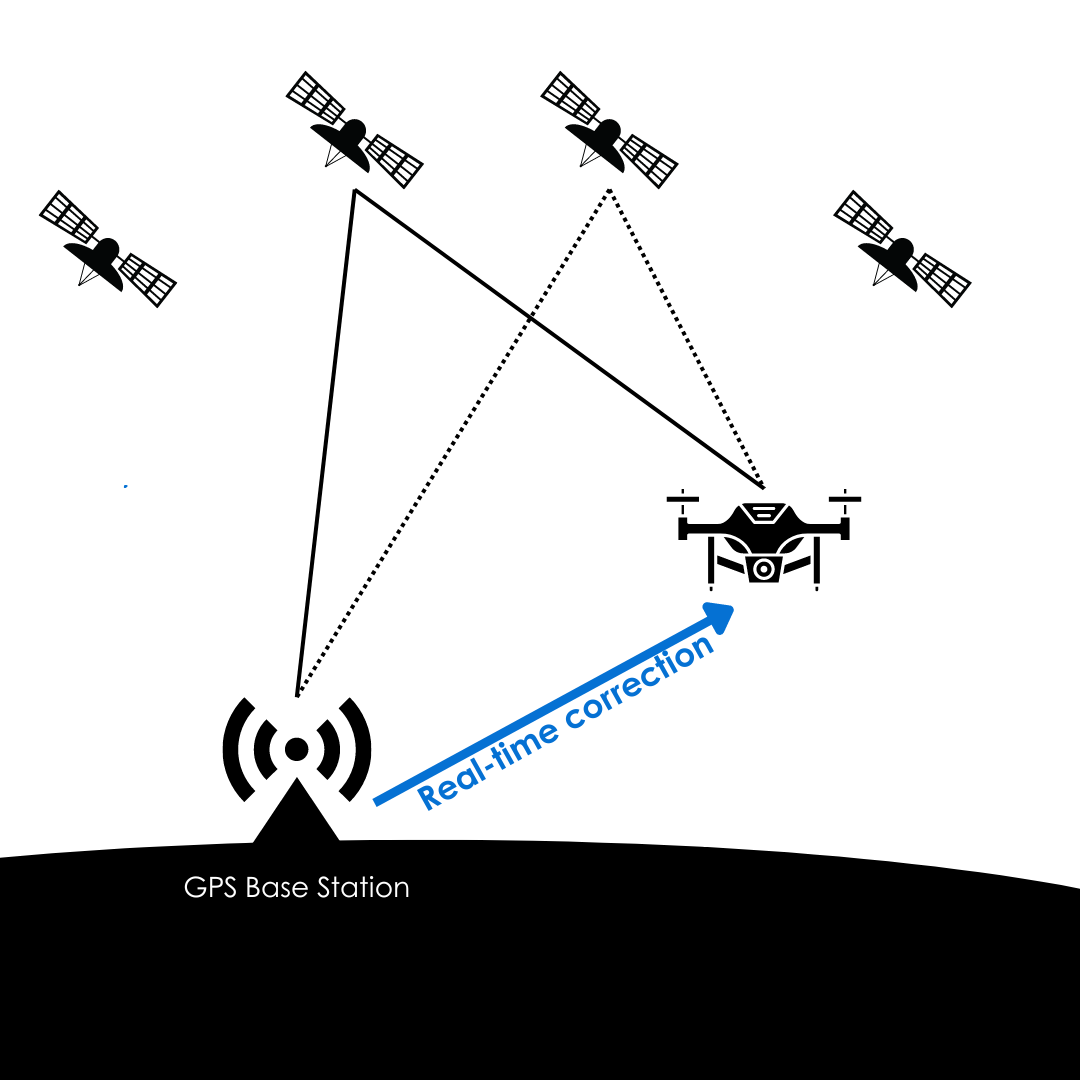
An alternative to this method is to use drones with RTK technology. RTK stands for Real-Time Kinematics, a system that enhances GPS accuracy by correcting signal errors in real-time. Drones with RTK collect photos with much higher precision without solely relying on GPS. This simplifies the post-processing of the data and also reduces the need for ground control points, saving time and increasing efficiency on the worksite.
Safety and Efficiency Benefits
RTK drones offer significant safety and efficiency advantages. Reducing the need to walk around an active construction site to set up GCPs minimizes the risk of accidents. Therefore RTK drones provide a more streamlined workflow, allowing operators to focus on other tasks without compromising the accuracy of the mapping data.
Studies Comparing Drones With or Without RTK
Studies have shown that RTK drones outperform traditional drone mapping methods in terms of accuracy and consistency. A notable study [Tomaštík et al. 2019] published in 2019 in the journal Remote Sensing found that in a forest RTK drones collected more precise data, both horizontally and vertically, compared to drones using ground control points. This precision remains consistent over time, even with seasonal vegetational changes, making RTK drones particularly suitable for long-term construction projects in more rural areas.
Despite the advantages of RTK technology, traditional drones with GCPs still have their place, especially in scenarios where fixed GCPs can be established. This approach can offer comparable precision, with the added benefit of data sets that are easily comparable over time.
You can find more research papers below under Sources.
Post-Processing and Data Sharing
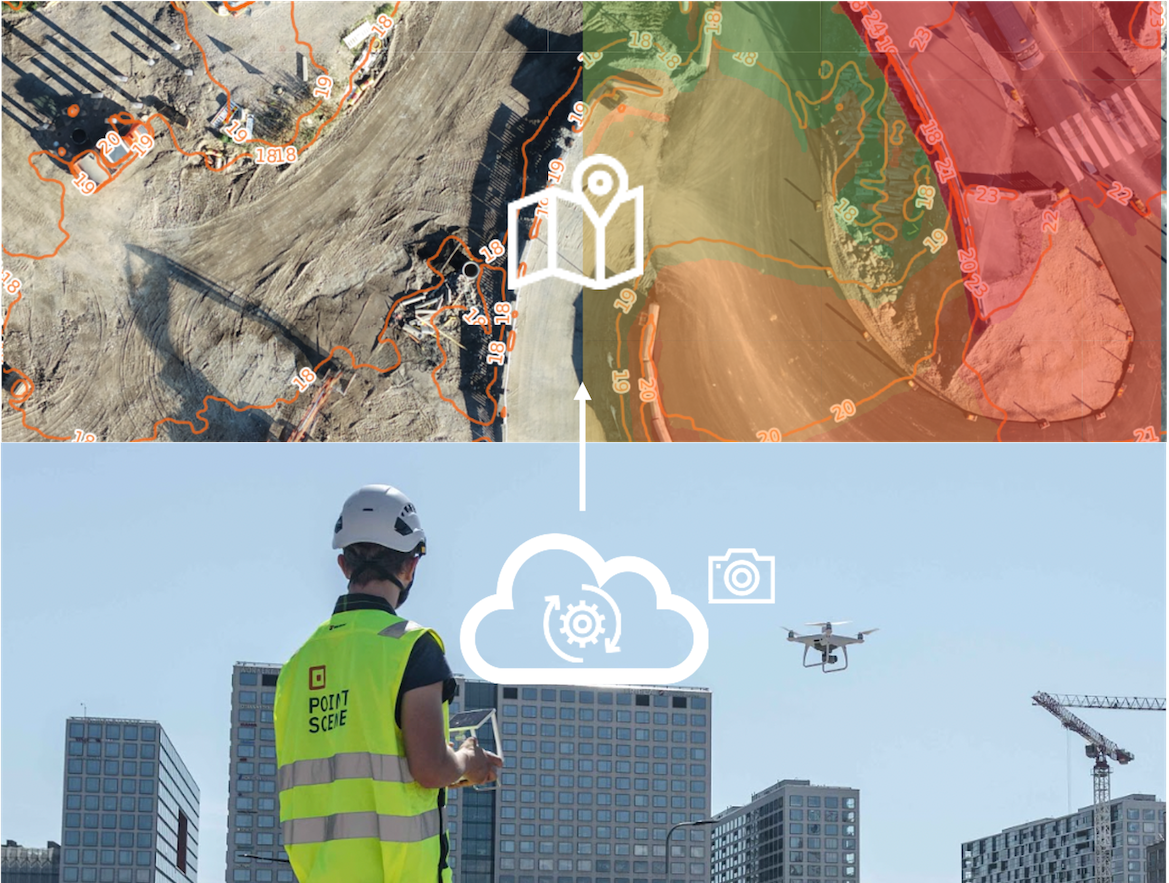
The absence of GCPs with RTK drones simplifies the post-processing of data. Various software solutions, both desktop and online, are available to handle this task efficiently. Online processing platforms, in particular, save computer resources and allow users to focus on other tasks while waiting for data processing. Pointscene’s Drone Map tool offers a user-friendly data processing and sharing platform. Simply just drag and drop the drone photos, select the output coordinate system and height correction and you are good to go! You will get orthophotos and surfaces to use for comparison and volume calculations and for sharing with open standard links like WMTS and WMS to other software and stakeholders.
Learn more about the Pointscene solution from customer case studies:
https://pointscene.com/case-studies/
Conclusion
In conclusion, RTK drones represent a highly efficient and cost-effective solution for collecting precise map data on construction sites. They streamline site visits, data collection, and processing, providing high-precision data quickly and safely. For those interested in exploring this technology further or utilizing Pointscene’s services, additional resources and research papers are available below for deeper insight.
If you have any questions or are considering incorporating RTK drone technology into your construction site mapping processes, feel free to contact us at Pointscene.
Sources
Matsuura, Y., Heming, Z., Nakao, K. et al. High-precision plant height measurement by drone with RTK-GNSS and single camera for real-time processing. Sci Rep 13, 6329 (2023). https://doi.org/10.1038/s41598-023-32167-6
Pointscene: https://pointscene.com/
Tomaštík, Julián & Mokros, Martin & Surovy, Peter & Grznárová, Alžbeta & Merganič, Ján. (2019). UAV RTK/PPK Method – An Optimal Solution for Mapping Inaccessible Forested Areas?. Remote Sensing. 11. 721. 10.3390/rs11060721. https://doi.org/10.3390/rs11060721
Vu Ngoc, Quang & Nguyen Viet, Ha & Ta, Le & Van, Hung. (2023). A Comparative Study of UAV Lidar, UAV, and GNSS RTK on Infrastructure Survey. IOP Conference Series: Materials Science and Engineering. 1289. 012098. 10.1088/1757-899X/1289/1/012098. https://www.researchgate.net/publication/373415363_A_Comparative_Study_of_UAV_Lidar_UAV_and_GNSS_RTK_on_Infrastructure_Survey