
Introduction
Orthophotos, or orthoimages, are georeferenced aerial photographs, corrected for distortions to represent the Earth’s surface as it would appear from directly above. These images are crucial in various fields such as cartography, surveying, and remote sensing. This article presents a comparative analysis of the accuracy of two orthophotos derived from the same raw imagery using Real-Time Kinematic (RTK) positioning, but processed using two different software, Pointscene Drone Maps service and Pix4D.
Methodology
The two orthophotos under study were generated from the same raw imagery captured by a drone equipped with RTK technology, which provides high-accuracy positioning. Despite their common origin, the orthophotos were processed using two different software, leading to potential variations in the final outputs. The accuracy of these orthophotos is assessed using both ground control points (GCPs) with known coordinates for global accuracy as well as various visible markings to assess the internal accuracy. The accuracy study itself was conducted using widely available software QGis, and the work consisted of measuring the difference of the selected points of interest.
The raw data used for the processing was gathered by Elton Mäki from Kreate Oy using DJI Phantom 4 RTK between October 2022 and June 2023. The coordinate system used was ETRS89-GK23FIN, EPSG:3877.
Accuracy Assessment
The accuracy of an orthophoto is typically evaluated in terms of its spatial resolution and geometric fidelity. Spatial resolution refers to the level of detail that can be discerned in the image, while geometric fidelity pertains to the accuracy of feature locations and distances.
Spatial resolution for Pointscene Drone Maps was 28mm, while the comparative orthophoto had resolution of 30mm.
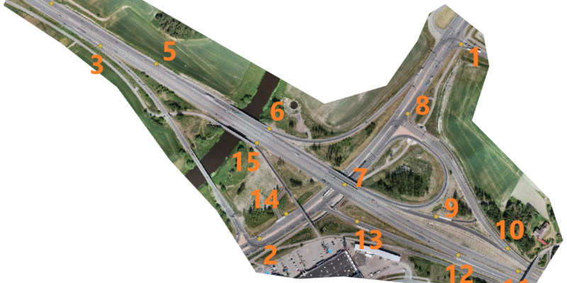
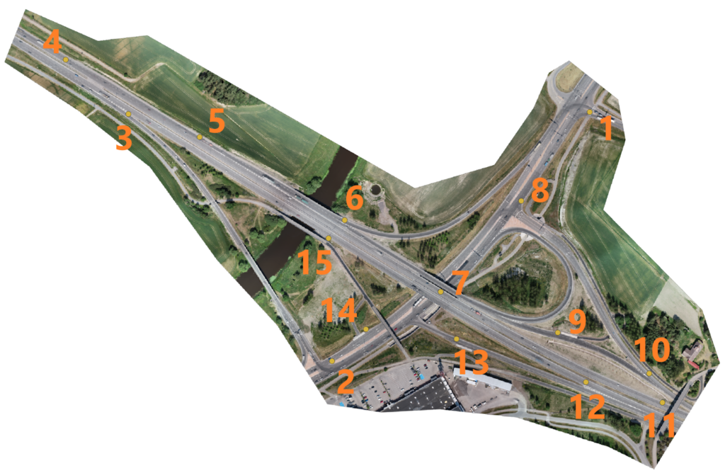
Geometric fidelity was calculated on both image-to-image comparison using 15 selected points clearly visible on both orthophotos as well as 8 points which were measured against surveyed ground control points (GCP’s). The spread of the 15 comparison points is displayed in the picture below. Image-to-image comparison was conducted for three different orthophotos and the results are averages of those figures, all being in line with one another. All values in the table are millimeters.
| Image to image comparison (15 points, 3 orthos) | Image to GCP comparison (8 points) | ||||
| x | y | x | y | ||
| avg. | 10,69 | 8,59 | 15,30 | 14,60 | |
| Std. dev. | 15,28 | 10,97 | 21,96 | 19,79 | |
| RMS | 16,72 | 13,42 | 22,06 | 24,54 | |
| Min/max. | +-45,00 | +-31,00 | +-34,00 | +-55,00 | |
Conclusion
The XY accuracy of the Pointscene Drone Maps service is very good, within 0,5 pixels of the orthophoto. Pointscene Drone Maps service can be used in the same way as any other drone-processed data where the required accuracy is centimeters instead of millimeters.
The Pointscene team would like to thank Kreate Oy and especially Elton Mäki for their contribution to the development and testing of the Pointscene Drone Maps service.