
Upload files
Use this Upload files page for all your uploads:
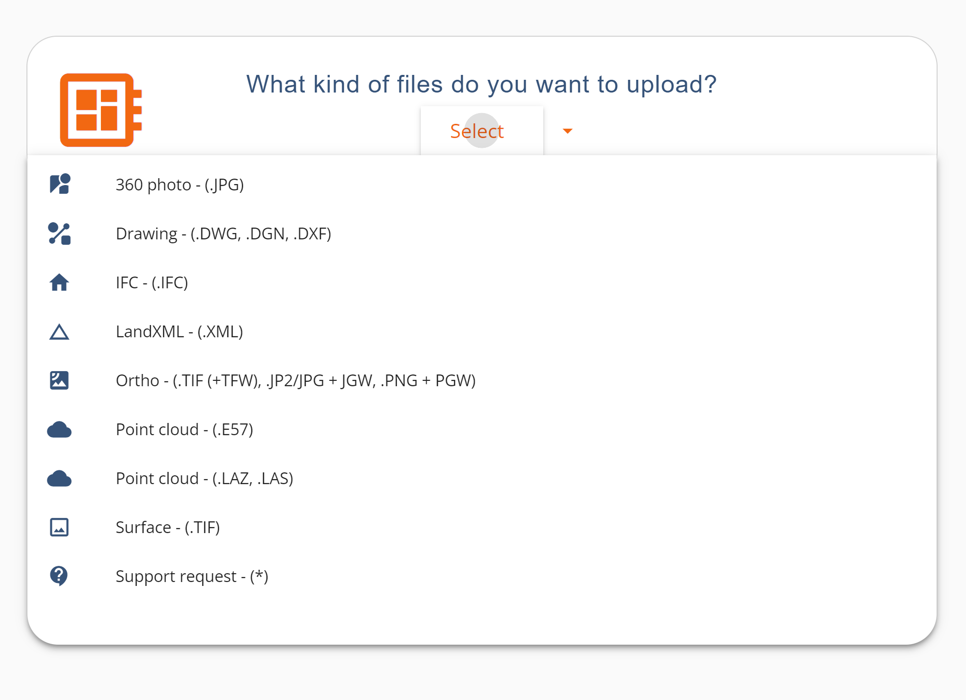
- 360 photo
- Drawings (DWG, DXF, and DGN without 3D objects)
- IFC models, version 2×3, max 50MB
- LandXML files: surfaces, (alignments and profiles are only visualized) max 50MB
- Orthophotos (TIF (+TFW), JP2/JPG + JGW, and PNG + PGW)
- Point clouds (LAZ, LAS, E57)
- E57 point clouds including 360 imagery (e.g. Leica)
- Surface (DSM or DTM (Geotiff))
Other files can be uploaded, but they will not be automatically processed. Other file types will be sent to our support team for further analysis and manual upload if possible.
SUPPORT REQUEST: Other file types that can be processed manually by our support team:
- Georeferenced images
- PDF files that have known coordinates or are georeferenced
- Esri Shapefiles (.shp), GeoPackage (.pgkg) & GeoJSON files will be converted into GeoTIFF for upload.
- Any file that cannot be processed for some reason
How to upload any file
- Open your site and go to OPTIONS and Upload files
- Drag and drop or select the files you wish to upload
- Note! Only the same file type for each upload (e.g. IFCs separately uploaded from LandXMLs).
- Select the file type and the date
- Provide an EPSG code for the dataset, you can type in your coordinate system name
- Click UPLOAD
- Wait until the file is uploaded. You will receive an email once your data is available.
- If you uploaded a “Support request” our Support team will contact you once the file is ready.
- You can always provide more info or ask anything from us at support@pointscene.com
Once your data is processed you can start using it in 2D and 3D viewing and calculations. Here is an example of LandXMLs: