
Cut – Fill – Volume – How are the values calculated?
Pointscenes measuring tools includes a Volume tool to calculate cut, fill and volume values from your data. If data is captured with a drone and you use DroneDeploy, Pix4D or Agisoft to process the data you will most likely get the DSM / DTM (surface model) raster layer at the same time. Surface models can also be generated from point clouds (Pointscene supports converting point clouds, send us an email at support@pointscene.com).
Pointscene uses raster data (.tiff / DSM / DTM) and LandXML surface files to calculate and compare volumes.

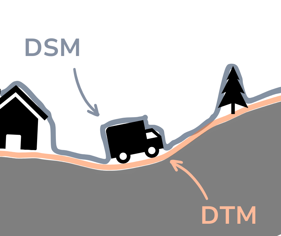
In the picture below you can how the DSM and DTM differ. DSM has all elements that are surveyed and the DTM has only the ground points.
The surface model is used to calculate volumes compared to some kind of reference surface. This can be a given height value (ie. +10.00), another surface model or the triangulated plane of the corner points of the area of interest. Let’s open this even more:
Say that you have 2 datasets from different times. First one is from June 2019 from an unfinished work site and the second one from November 2019 with a completed sports yard.

In June 2019, at the time, there were piles of soil around the yard. All soil is needed as taking it away costs money and buying too much soil costs money. So we need to know how much soil we need to even out the yard at a solid level.
Pictured below is a pile that is going to be used for the yard. We need to know its volume.

By selecting the area and the right surface model (June 2019) we get the volume report. Pointscene calculates the volume by triangulating the surface between selected points and then comparing them to the surface model and we can see that the pile has roughly 13.8m³ of material in it and the height is about 1,39m.
Other options for volume calculations include comparing area to a given plane height or to another surface model (DTM, DSM or LandXML). In both cases Pointscene compares the selected area to two surfaces selected or to the given height and calculates the volume from those differences.
If we want to level the ground to a certain value, we can use plane. Notice the the ground level on the edges is about 29.6m.

If we want to now how much land was moved in the same area, we can compare 2 different sets of data. On the left is the older dataset (top) and on the right (bottom) the newer finished surface. There was 5.8m³ more soil in the selected area than needed, but of course it was used over the entire area.

The edges of the original pile are below the current level of ground (light blue, about -20cm) and the rest was over the final height (red).
