
How to add WMS to Gemini Terrain 15.1
Pointscene supports custom coordinate systems for WMS and the default is EPSG:3857. If your local projection is not supported, please contact support@pointscene.com and we’ll fix it!
1. Copy WMS link from Pointscene (Site Options, Publish data)
2. In Gemini Terrain version 15.1. or newer, make sure you have the correct coordinate system selected for your model. Go to project settings before adding the WMS layers.
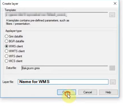
3. Right-click the “Applayers” panel and select New…
4. Select Applayer type: WMS Client and type a name for the Layer File. Click Create.
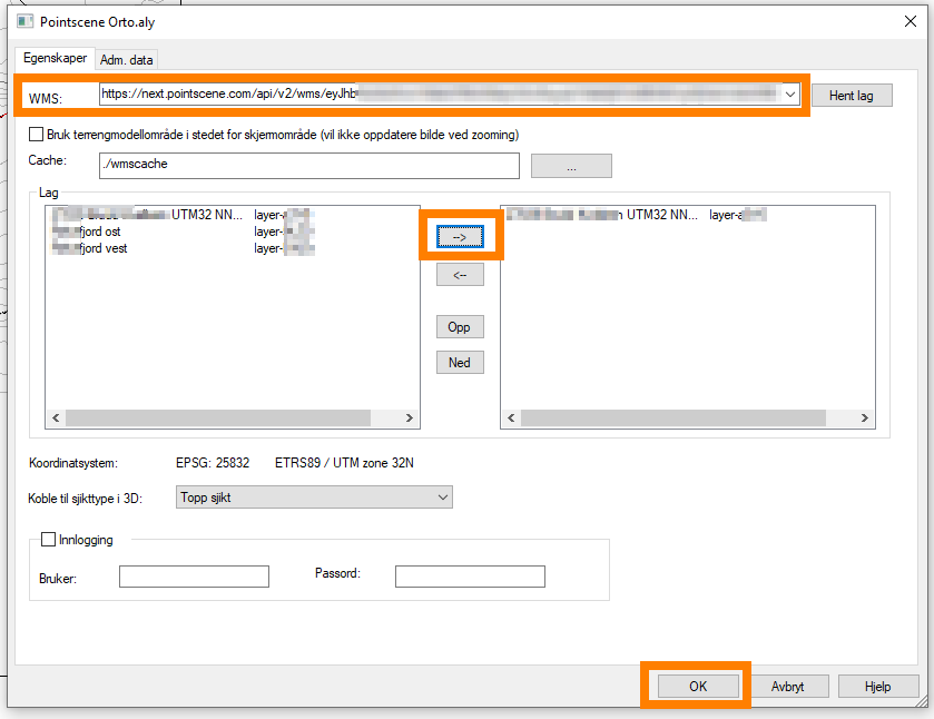
5. Add link to WMS and click “Get layers” or “Hent Lag”
6. Select which layers you want to see in the map and click OK.
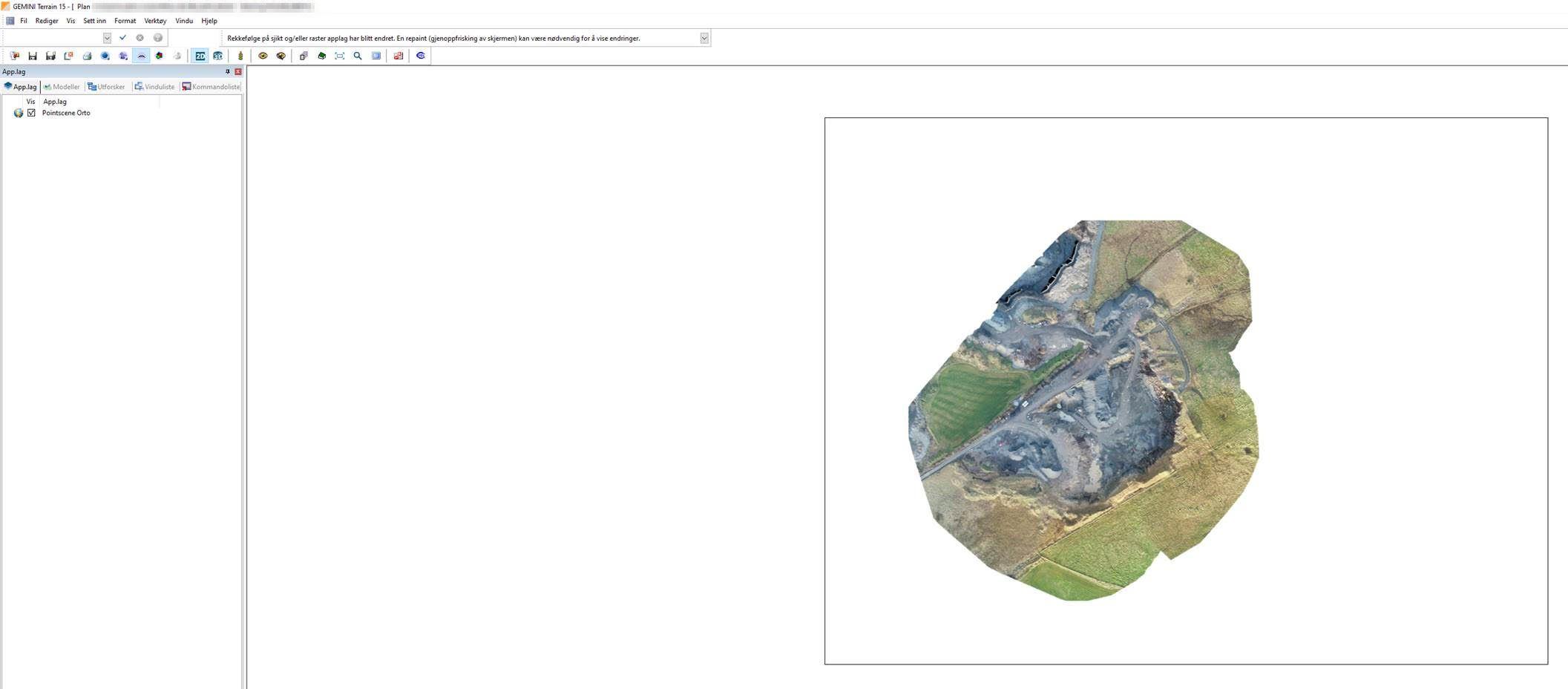
7. WMS layer should appear to the map.
For more support using Powel Terrain, please contact Powel Constructions.
Tutorials: https://www.powel.com/support/construction/gemini-terrain?activeTab=tutorials
Short video of adding a WMS (in Norwegian):