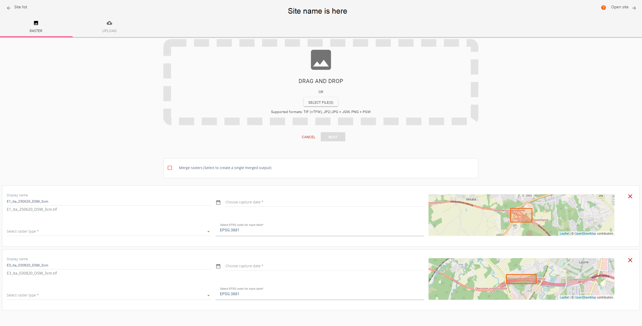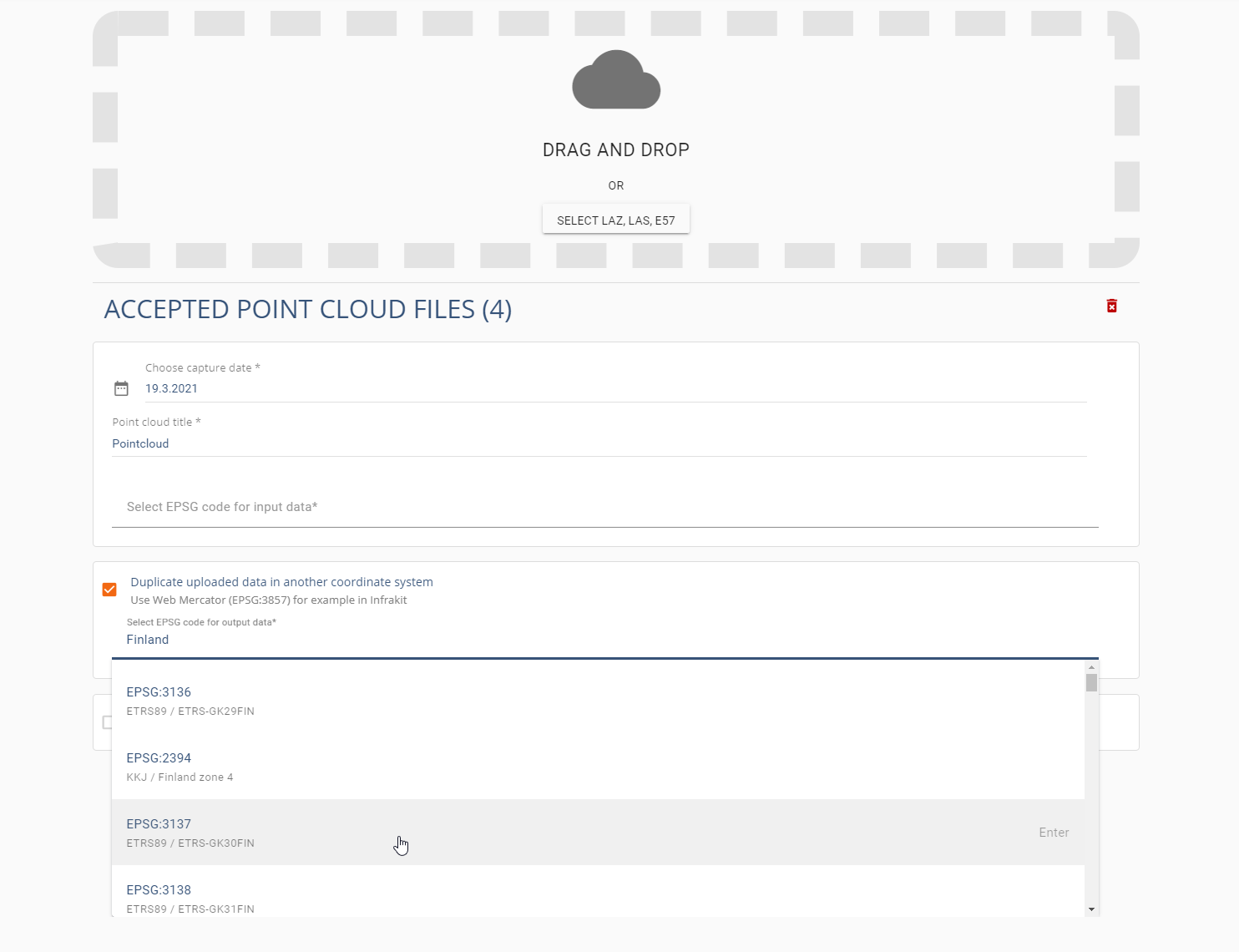
We have updated our raster and point cloud uploading pages. Now our customers can easily upload multiple raster and merge them together if needed. Also users can convert a point cloud to another coordinate system e.g. for Infrakit usage.
All updates:
- Upload multiple rasters at once (instructions)
- EPSG code search with coordinate system name or country (e.g. Finland, GK25, …)
- Merge rasters into one layer (instructions)
- Convert point cloud to another coordinate system (instructions)
- Needed for Infrakit 3D viewer for point clouds and models
- Show preview map extend for jp2, jpg, and png raster when given a world file and epsg code
- EPSG code is now required metadata for point cloud upload
- Updated base map (OpenStreetMap) for preview map
- Site name is visible on the upload page