
Introduction
Autodesk® Civil 3D® is a comprehensive design and documentation software used by civil engineers to plan, design, and manage civil infrastructure projects. This article focuses on the integration of drone orthophotos, Digital Surface Models (DSMs), and Digital Terrain Models (DTMs) into Civil 3D® via Web Map Tiled Service (WMTS) or Web Map Service (WMS). Unlike general public orthophotos or satellite base maps, drone orthophotos offer high accuracy, up-to-date imagery, and cost-efficient data acquisition on demand. These features are particularly beneficial during construction when reliable and measurable orthophotos are essential. The following sections explore the advantages and practical applications of incorporating these drone-generated data sources into Autodesk® Civil 3D® workflows.
Benefits and Use Cases
Accurate Site Visualization and Topographic Surveys
- Benefit: Enhanced site visualization improves the accuracy of initial designs and planning, reducing the likelihood of errors and reworks.
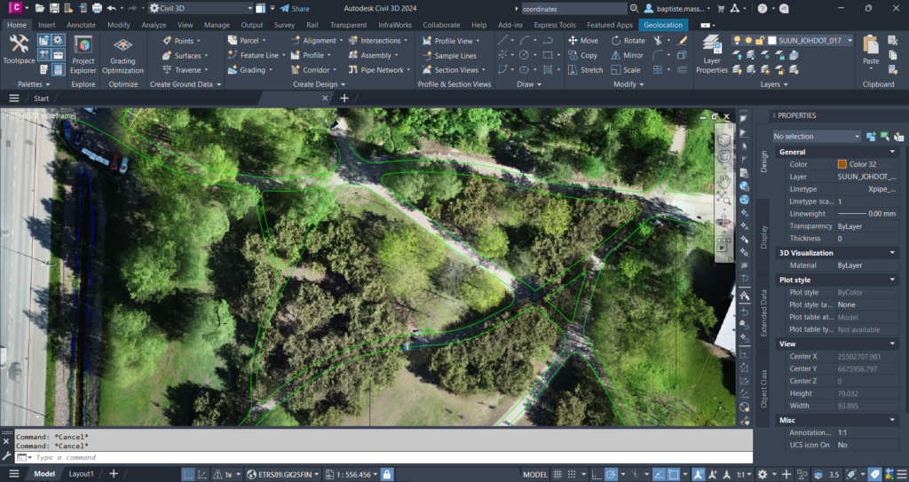
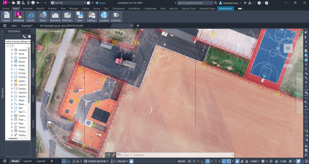
- Use Case: Before starting a new road construction project, civil engineers can overlay high-accuracy drone orthophotos onto their Civil 3D® base maps. This provides a clear, current view of the existing site conditions, helping to identify natural features, man-made structures, and potential obstacles. For example, in planning a road, engineers can accurately map out the route by identifying existing vegetation and water bodies that need to be preserved or modified.
Up-to-Date Data and Monitoring
- Benefit: Up-to-date data helps to ensure that the construction is done according to the design specifications, reducing delays and cost overruns caused by unexpected site conditions.
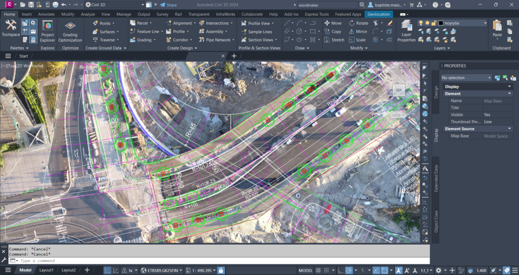
- Use Case: During construction, drones can capture updated orthophotos, DSMs, and DTMs at regular intervals. These images can be shared via WMTS or WMS and integrated into Civil 3D®, allowing engineers to monitor progress and make necessary adjustments to the plans. For instance, in a joint venture project where design and construction phases overlap, up-to-date data allows for immediate modifications to the design based on current site conditions, such as unexpected terrain changes or new obstacles.
Enhanced Collaboration
- Benefit: Improved collaboration leads to more efficient decision-making and problem-solving, minimizing conflicts and project delays.
- Use Case: Orthophotos, DSMs, and DTMs shared through WMTS or WMS can be accessed by all stakeholders, including project managers, contractors, and regulatory bodies. This ensures everyone has the most current site information, facilitating better communication and collaboration. For example, in a park design project, landscape architects and engineers can simultaneously access the latest orthophotos to ensure that pathways, seating areas, and playgrounds are optimally placed with respect to existing trees and terrain features.
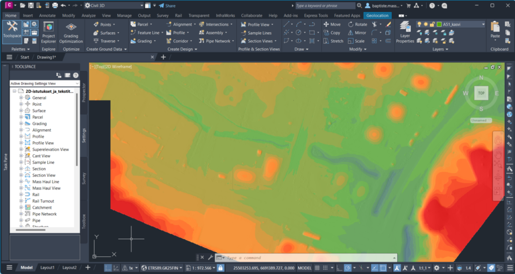
Improved Situational Awareness and Environmental Integration
- Benefit: Increased situational awareness helps engineers make more informed decisions, ensuring the design fits better into the real-world environment.
- Use Case: During the planning and design phases, civil engineers can use drone orthophotos, DSMs, and DTMs to gain a comprehensive understanding of the project environment beyond what a base map or initial data provides. This includes observing vegetation, water bodies, terrain variations, and existing infrastructure. For instance, when planning a new park, elevation colors and orthophotos can reveal existing tree lines, natural water flows, and public pathways that should be preserved or incorporated into the design, ensuring a harmonious integration with the natural environment.
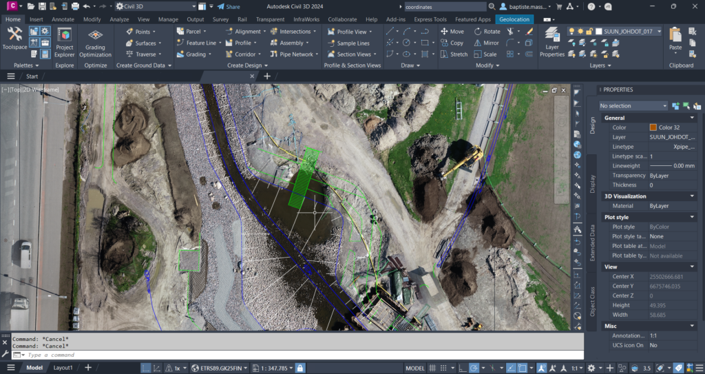
Design Validation and Clash Detection
- Benefit: Validating design elements and detecting potential clashes early prevents costly rework and project delays.
- Use Case: In a utility installation project, engineers can overlay the orthophotos, DSMs, and DTMs with proposed pipeline routes to ensure there are no conflicts with existing infrastructure or natural features, such as trees or water bodies. This helps in adjusting the pipeline paths in real time to avoid clashes and maintain project schedules.
As-Built Documentation
- Benefit: Accurate as-built documentation ensures that all constructed elements meet the original design specifications, facilitating final inspections and approvals.
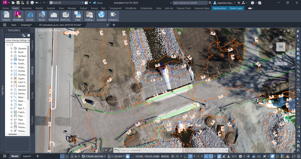
- Use Case: Post-construction, drones can capture orthophotos, DSMs, and DTMs to create accurate as-built documentation. This imagery is integrated into Civil 3D® to compare the completed work with the original design. For residential development, as-built orthophotos can verify that all roads, utilities, and structures are constructed as planned. This ensures that the project complies with regulatory standards and helps in the efficient handover of the site.
Conclusion
Integrating drone orthophotos and surface models into Autodesk Civil 3D® through WMTS or WMS offers civil engineers a powerful tool for accurate site visualization, up-to-date updates, enhanced collaboration, and improved project outcomes. By leveraging up-to-date, high-accuracy imagery and surface models, engineers can make informed decisions, validate designs, and adapt to changing site conditions, ultimately ensuring the successful completion of infrastructure projects.
With Pointscene, civil engineers and construction projects/contractors can use industry-leading sharing tools to achieve all these benefits. Pointscene is the only cloud toolkit for construction professionals that provides open standard sharing capabilities for orthophotos and surface models. Our orthophoto sharing is also automatic, ensuring that all stakeholders receive the newest orthophoto updates directly in their base maps. This eliminates the need to ask or wonder if a more recent dataset is available, ensuring that your initial data is always the most current. By embracing this technology, civil engineering designers can significantly enhance their workflows, reduce risks, and deliver higher-quality projects in a timely and cost-effective manner.