
(Est. read time: 3 min)
In today’s fast-paced world, efficiency and accuracy are always present in the construction industry. One tool that has revolutionized the way construction managers and workers approach their projects is the work site’s own Web Map Services (WMS). Here’s what you need to know about WMS and how it can be applied to your work.
What is WMS? 🌍
WMS is an acronym for Web Map Services, a standard protocol for sharing 2D maps online. This technology is used globally and has been around for many years. Governments and municipalities often utilize WMS to share public information. The usage of WMS is increasing as construction software becomes more map-centric.
How Does WMS Work? 👷♀️
WMS essentially shares a map image over the internet. The WMS system provides a URL that can be shared. However, this URL doesn’t come with a viewer, and you’ll need specific software to read and use the map service.
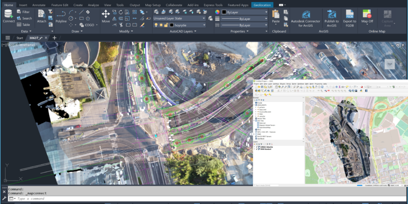
Popular software like QGIS supports WMS, and it can be either desktop or browser-based software. You enter the URL, get a list of layers into your software, and then you’re ready to go. Many different kinds of software, including Autodesk Civil 3D, can read WMS links.
On-Demand Based Software 🖥️
One of the useful features of WMS is its on-demand nature. It works only when there is a request. When you zoom into an area on the map, the WMS service returns only a photo of that part of the original data. It’s incredibly responsive, providing images based on your real-time needs. For faster response, you may also utilize Web Map Tile Service (WMTS) if your software allows it.
Applications in Construction 👷♀️
In construction, WMS offers several powerful applications. You can overlay it with other data like 2D or 3D CAD and BIM drawings & project plans. Having up-to-date reality capture data as a background improves situational awareness without even having to visit the site.
WMS can speed up the work for managers, designers and workers. For instance, once you’ve added the data on the map, you can begin designing, measuring areas, estimating stock products, and much more. It will lead to better coordination and efficiency.
WMS and Photogrammetry 🌍
Photogrammetry is the theory behind how drones with cameras can collect 2D/3D data from a work site. It’s an old science that allows the creation of highly accurate 2D maps or 3D models using overlapping photos.
The resulting aerial images can be shared to different software and stakeholders. They can use the WMS in various construction activities, such as site planning, safety assessment, and progress monitoring. It creates an extra layer of precision that can significantly enhance your construction projects.
Conclusion 🏁
Web Map Services (WMS) provides a unique and powerful tool for construction workers and managers. By understanding how it works and leveraging its applications, you can streamline processes, enhance accuracy, and increase productivity on your construction sites. Whether you’re a seasoned manager or a construction worker new to technology, WMS offers invaluable benefits to explore and integrate into your workflow. It’s a step towards modern, efficient, and tech-driven construction management.
Next Steps ➡️
Need help to get started with using WMS? Pointscene Web is an easy online tool for managing your orthophotos and creating WMS links from them.
Learn how to create WMS links:
Have a chat with our experts: