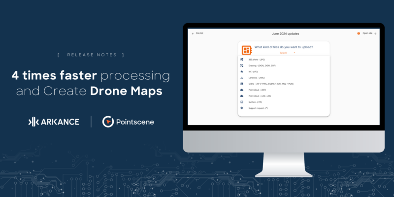
Photogrammetric processing and streamlined uploading – Pointscene users will save a lot of time with this update!
What we heard:
Pointscene is easy to use, but waiting for the newest dataset to be processed can take long. Having separate upload pages for different formats has been confusing, as some of them are from the same Upload file page and some are still separate.
Many of you use RTK drones and use only orthophotos and surface models to track progress. Relying on the RTK accuracy, drone photos can be processed without ground control points and could be done automatically.
What we did:
- Combined all upload pages into one Upload files page
- Removed “Upload raster”, “Upload point cloud”, “Upload photos”
- We rearranged the order tools in the OPTIONS menu
- Streamlined the processing of orthophotos and point clouds speeding up the processing time (2 times faster for orthos and 4 times faster for point clouds)
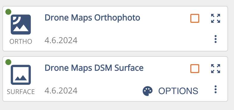
- Created Drone Maps
- Photogrammetric processing drone photos into maps (orthophotos and surfaces)
- Added a new purchase process for photo packages
- Backend updates
- All file types are now processed with our API.
- All sharing links (WMS, WMTS,..) are now created with our API and have a different structure
- We have retired the Ortho Composite layers from the complilation link. Please contact support if you needed it!
- All old share links (starting with next.pointscene….) still work. The user interface shows now only new links (starting with api.pointscene…)
- Geotagged photo upload is hidden, please use “support request” for uploading geotagged photos.
How it works:
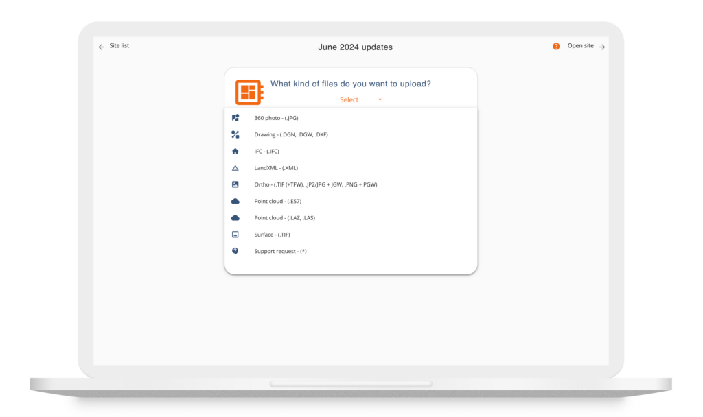
Upload files
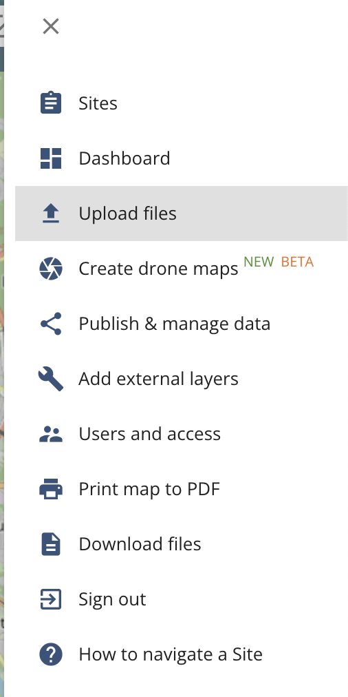
We rearranged the order tools in the OPTIONS menu, you can find the Upload files as third:
Select the file you want to upload and follow the steps. You can upload multiple files – one type of data at once.
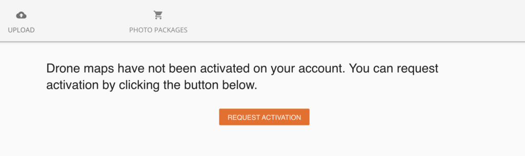
Create Drone Maps
First the user must activate the Drone Maps feature – so that they have the right to purchase photo packages. Select any site and click OPTIONS > Create Drone maps > Request activation.
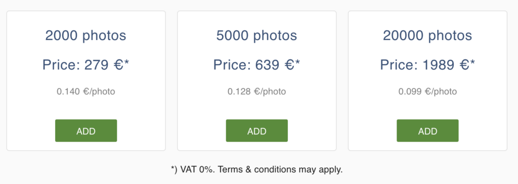
After you have been given the purchase rights you can select a photo package:
After that you are ready to start processing!
- Go to the site you want to process drone photos
- Select Options > Create Drone Maps > add photos
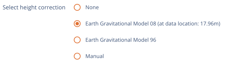
- Provide a name, output EPSG code and height correction for your photos.
- If you don’t know what height correction is needed we recommend “Earth Gravitational Model 08”. Pointscene fetches the right correction at the location of your photos.
- Most users will likely use the “Manual” mode and get a more accurate correction from their local geoids in their country.
Follow the steps and you’ll get your orthophoto and surface model available typically in 2-3 hours