
Infrastructure megaprojects grow more complex every year, and traditional progress tracking methods can’t keep up. Site visits and weekly meetings aren’t giving stakeholders the situational awareness they need to respond quickly when work runs into surprises. The result is familiar: costs grow, timelines stretch, and profit margins shrink.
In response, some of Europe’s leading construction firms are using a drone-capture workflow— one devised by a partnership of Infrakit and Pointscene to meet the needs of the most demanding infrastructure megaprojects.
Advanced progress tracking
Here’s how the workflow looks in practice: The project flies drone missions regularly to capture orthophotos and record progress. Then they upload the individual data sets to Pointscene, using the platform’s powerful tools to manage and organize the data. Last, they use Pointscene’s web services to push the orthos directly to Infrakit—putting data right where stakeholders need, enabling them to make confident choices as the project changes.
3 case studies
Read on to see how three infrastructure megaprojects used this workflow to track progress and gave all of their stakeholders the situational awareness they need to succeed.
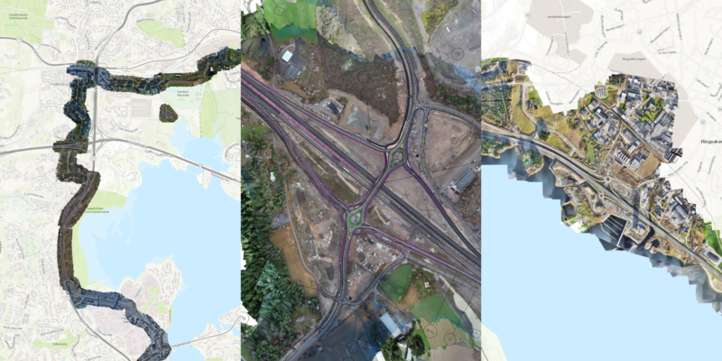
Jokeri Light Rail, Finland
About: A construction alliance consisting of cities Helsinki and Espoo, three design companies, and two contractors are building the Jokeri Light Rail. Construction began in 2019, with a plan for the rail to begin operation in 2024.
Stats
- Size/length: 25 km with 34 stations
- Budget: light rail network and infrastructure 386 M€, depot 70 M€
- Work duration: 375 man-years per year (= total 1510 man years during the 5-year project)
Raidejokeri’s tracking workflow
- Capture drone data and create orthos 10-15 times weekly
- Upload data to Pointscene
- Automatically push data to project management software, including Infrakit and Louhi, as dynamic aerial basemaps. Data also used with design/survey software like AutoCAD and 3D-Win
Results
“At Raidejokeri we are more confident in our decision-making because of updated situational awareness, which results in significant time savings. We can now update our ortho compilation basemap 100x faster than before.”
– Tomi Mäkelä, Head Surveyor
![]()
Turku E18 Ring Road, Finland
About: Leading Finnish contractor Destia was performing improvement work on the Turku E18 Ring Road, a main route between to Helsinki driven by as many as 13,500 vehicles per day.
Stats
- Size/length: approx. 6 km, with 12-14 underpasses and bridges
- Budget: 40 M€
Destia’s tracking workflow
- Capture drone orthos 1-5 times a week
- Upload data to Pointscene
- Use Pointscene to push data to Infrakit automatically , where it is used as worksite planning and reference materials during regular meetings
Results
“Pointscene enables us to provide up-to-date imagery to the planners and builders in a much more efficient manner than before. No more external hard drives – we upload the material directly to Pointscene cloud where it is immediately available in stakeholder software.”
– Antti Heikkinen, Head Surveyor

E6 Arnkvern – Moelv, Norway
About: Norwegian construction and civil engineering company Veidekke is building a new section of the E6 highway, the main North-South route throughout Norway and the West Coast of Sweden.
Stats
- Size/length: 24 km
- Budget: 245 M€
Workflow
- Capture high-resolution drone map for the whole project monthly
- Upload data to Pointscene
- Automatically push data to CAD/BIM and survey software like Infrakit and Gemini Terreng to use as dynamic basemaps
Results
“Now we can deliver the aerial information for our construction team several days faster and with super high resolution. No need to compromise speed or quality.”
– Anders Hoel Nielsen, Survey Engineer
![]()
On time and under budget
As you can see from above, these extremely large projects are able to track progress with little effort and put up-to-date site information where stakeholders need it. This gives everyone the situational awareness they need to respond confidently when surprises pop up—so work can finish on time and under budget.