
Company
Destia is a Finnish infrastructure and construction service company that creates tomorrow’s infrastructure for its customers, the society and its people. Destia designs, builds and maintains traffic routes, industrial and traffic environments, as well as completes living environments. Destia’s services cover subterranean construction, extensive overground operations, and range from demanding foundation engineering projects to energy and engineer construction. As Destia possesses versatile expertise, they are able to carry out large-scale, advanced solutions.
Source and more info: destia.fi
Project Stats
- Size/length: approx. 6 km, with 12-14 underpasses and bridges
- Budget: 40 M€
- The project was constructed in 2 phases, this is the first phase by Destia. The second phase was by Kreate. Pointscene was used by both parties.
- ∼ 90 000 000 € total costs (org. budget 98 M€)
- 21.1.2023 graduation seminar in Turku. (6 months early)
Goals
Make sure daily work routines are efficient and everyone is up-to-date on the current situation.
Provide all workers an updated view of the construction site using drone data (weekly updates)
Solution
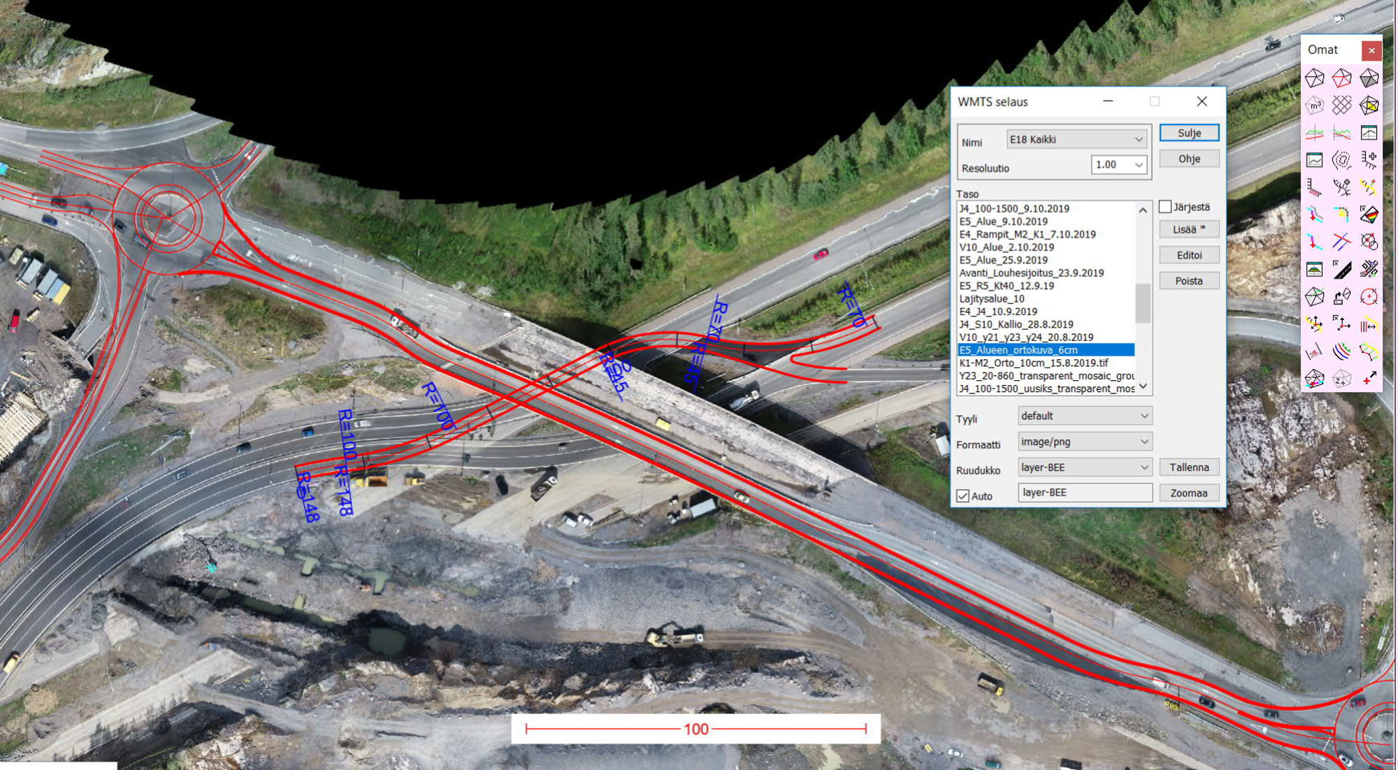
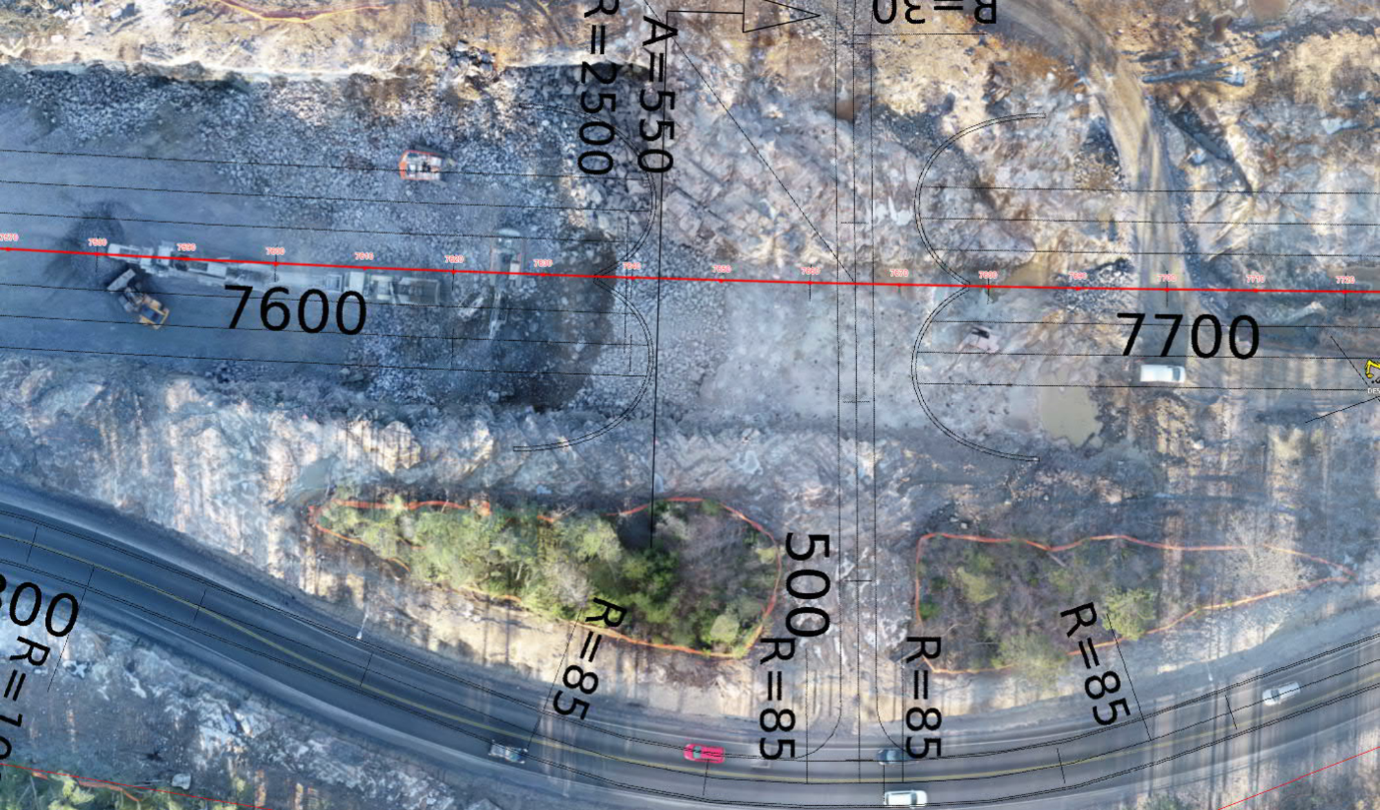
- Data capture about once a week on active areas, processed data uploaded to Pointscene.
- Downloadable point cloud and orthophotos organized by time and place can be found easily when needed
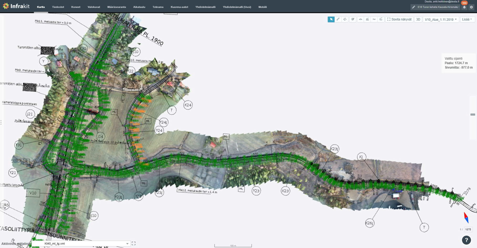
- Pointscene orthophotos are shared to Infrakit and used there for worksite planning and as meeting material and guidance
- Data is also shared to 3D-Win survey software users either via web map service or as downloadable files
- No need to use external drives to share or manage datasets related to the project, as all is found and safe in Pointscene
Results
- All Infrakit users in the project constantly use the orthophotos as base maps and as-built reference data.
- Meetings are supported by using Pointscene orthophotos and point clouds for communication and to understand the current situation
- Chief Surveyor uses the data for stockpile management, reporting and survey work guidance
- Site Manager and Project Manager constantly ask for new updated orthophotos, as they use them for their daily work
- The whole project was finished under budget 10% and 6 months ahead of schedule.
- The project was constructed in 2 phases, this is the first by Destia. The second phase was by Kreate. Pointscene was used by both parties.
- more info about the results
- In Finnish
- In English (Google Translate) (you might need to accept the cookies before you can see the article)