
As the demand for geospatial data grows, industries are looking for faster, more accurate ways to collect critical information. Handheld iPhone scanners with enhanced GPS are stepping up to meet this need, combining the convenience of mobile technology with professional-grade precision. This game-changing technology empowers different players in the infrastructure construction field to capture detailed 3D data with unprecedented ease and accuracy.
In this article, we dive into the technology behind handheld iPhone scanners for point cloud collection, explore real-world use cases, and highlight how pairing these devices with platforms like Pointscene can unlock new possibilities for data visualization and decision-making.
The Technology Behind Handheld iPhone Scanners with GPS
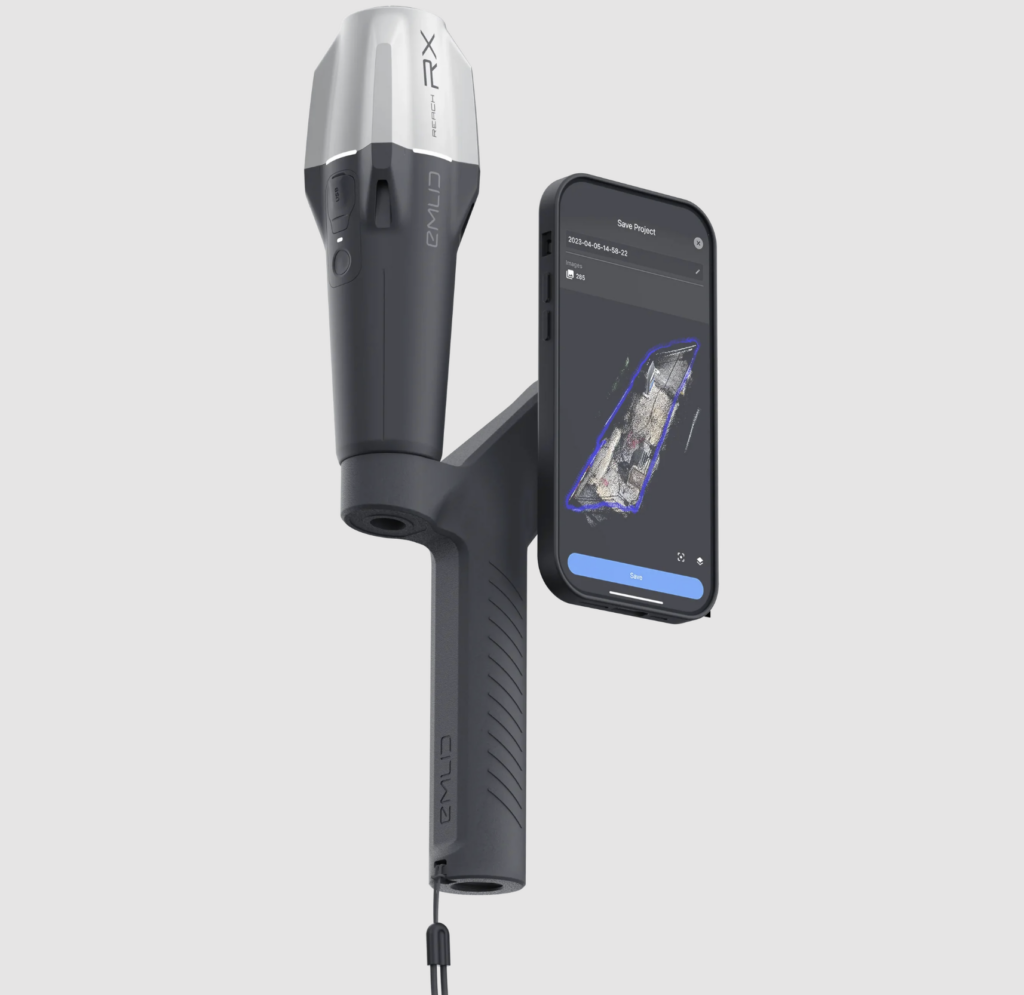
Handheld iPhone scanners offer a user-friendly, portable solution for generating 3D point clouds. Paired with additional GPS antennas, they take accuracy to the next level—delivering the geolocation precision essential for industries that rely on accurate spatial data.
Key Components:
- Integrated iPhone LiDAR and Camera: Modern iPhones, particularly the Pro models, come equipped with LiDAR sensors that generate detailed 3D representations by measuring the distance of objects around them.
- External GPS Antennas: While built-in GPS is sufficient for consumer applications, industries like construction and surveying require centimeter-level accuracy. Additional GPS antennas provide this by accessing multi-frequency GNSS signals and Real-Time Kinematic (RTK) corrections for higher precision.
- Real-Time Data Collection: This combination of LiDAR and high-precision GPS enables users to capture and process point clouds in real time, even in challenging environments like dense forests or urban areas.
How Handheld iPhone Scanners Are Used
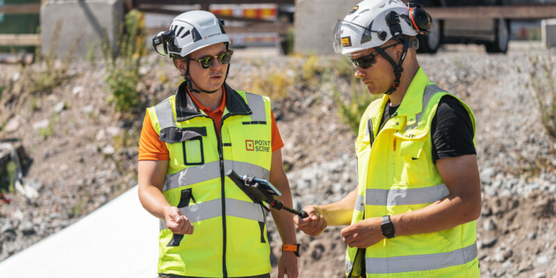
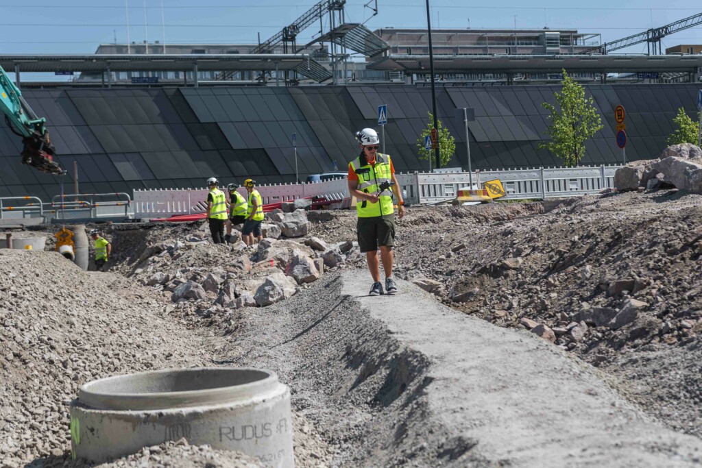
Handheld iPhone scanners with enhanced GPS antennas are transforming data collection across various industries. Professionals use these tools in everything from construction sites to the forest industry to capture high-accuracy point clouds easily. The process is simple—scan the environment with the iPhone’s LiDAR sensor while collecting GPS data to ensure precise geolocation.
Why It Works:
- Ease of Use: No bulky equipment—just a handheld device and external GPS antenna.
- Portability: These scanners are compact and affordable, making them accessible to small businesses and mobile professionals.
- Immediate Results: Scanned data can be processed in real time, shared instantly, and uploaded to platforms like Pointscene for further analysis.
Use Cases for Handheld iPhone Scanners with GPS Antennas
The versatility of handheld iPhone scanners is clear across industries, where enhanced GPS capabilities enable more accurate data collection and improved decision-making. Here are some key examples:
- Construction and Surveying: Surveyors and construction teams use handheld scanners to capture detailed 3D models of infrastructure, ensuring that projects are built to exact specifications.
- Urban Planning: Architects and city planners can map out urban environments with precision, supporting efficient land use and development.
- Forestry and Environmental Monitoring: From tree growth assessments to erosion monitoring, handheld scanners provide critical data for land and resource management.
- Utilities and Infrastructure: Scanning assets like power lines or pipelines helps utility companies conduct maintenance and plan expansions with pinpoint accuracy.
- Real Estate and Facility Management: Real estate professionals can create 3D property scans for virtual tours and asset management, with enhanced GPS ensuring accurate placement within the surrounding area.
Using Point Clouds with Pointscene
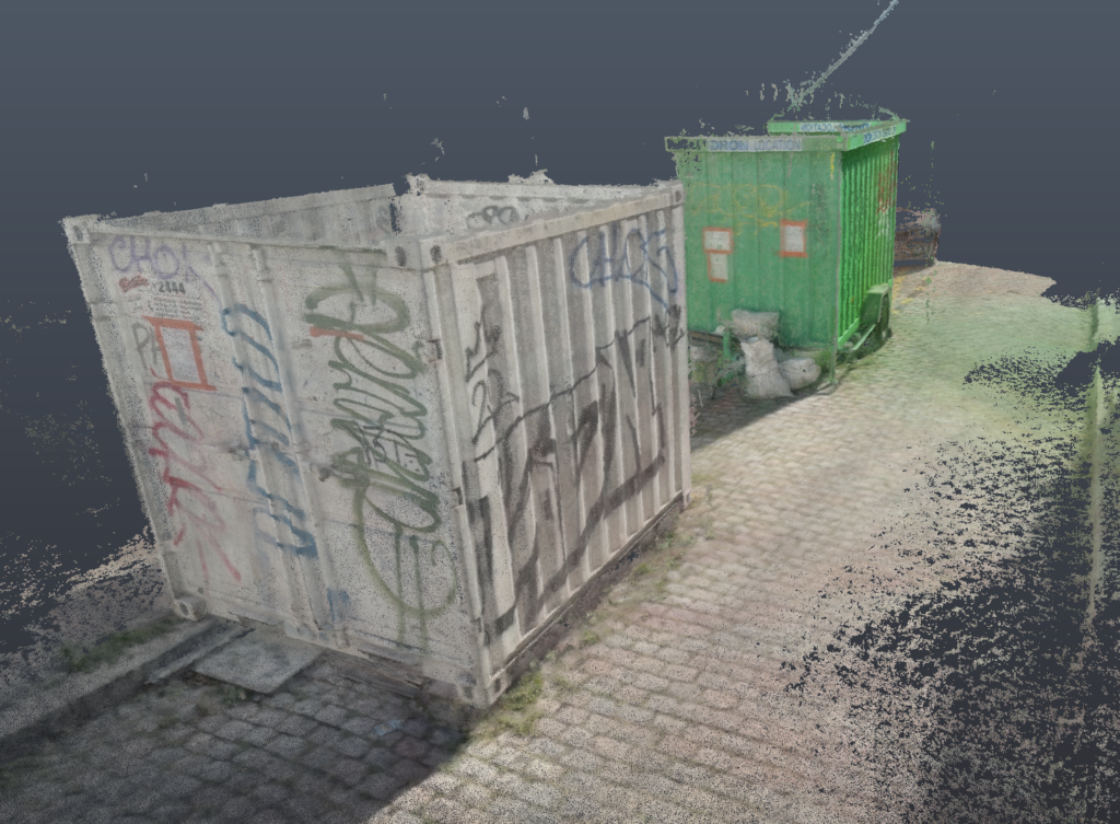
The actual value of point clouds comes to life when uploaded to a platform like Pointscene. Pointscene allows businesses to manage, visualize, and analyze 3D data, transforming raw point clouds into actionable insights.
Pointscene’s Key Features:
- 3D Visualization: Upload your point cloud to Pointscene and explore it in an interactive, immersive format.
- Data Layering: Compare and layer multiple types of geospatial data—like satellite imagery and orthophotos—on top of your point cloud for deeper insights.
- Collaboration and Sharing: Share your data with stakeholders to ensure everyone is working from the most up-to-date information.
- Geospatial Analysis: Use Pointscene’s analytical tools to gain critical insights, from measuring distances to monitoring environmental changes.
Conclusion
Handheld iPhone scanners with enhanced GPS antennas are changing the point cloud data collection landscape. Whether you’re in construction, urban planning, or environmental monitoring, this technology offers a mobile, precise, and cost-effective solution. When combined with platforms like Pointscene, businesses can unlock the full potential of their 3D data—transforming how they visualize, analyze, and collaborate on their projects.
Handheld iPhone scanners and Pointscene offer an unbeatable combination of accuracy and insight for any business looking to harness the power of geospatial data.
You can read more articles like this on our blog: Pointscene.com
Some of our top pics:
Drones vs. Laser Scanners: Tools to produce point clouds for your project