
(Est. read time: 4-5min)
In the world of surveying and mapping, technology has brought us two powerful tools for point cloud production: drones and laser scanners. Both have their unique capabilities and applications, but how do you decide which one to use? Let’s explore the examples and benefits of using drones and laser scanners to understand their distinct advantages.
Drones: The Aerial Advantage ✈️
Drones, or Unmanned Aerial Vehicles (UAVs), have revolutionized the way we survey large and open areas. Here’s why drones might be the right choice for your project:
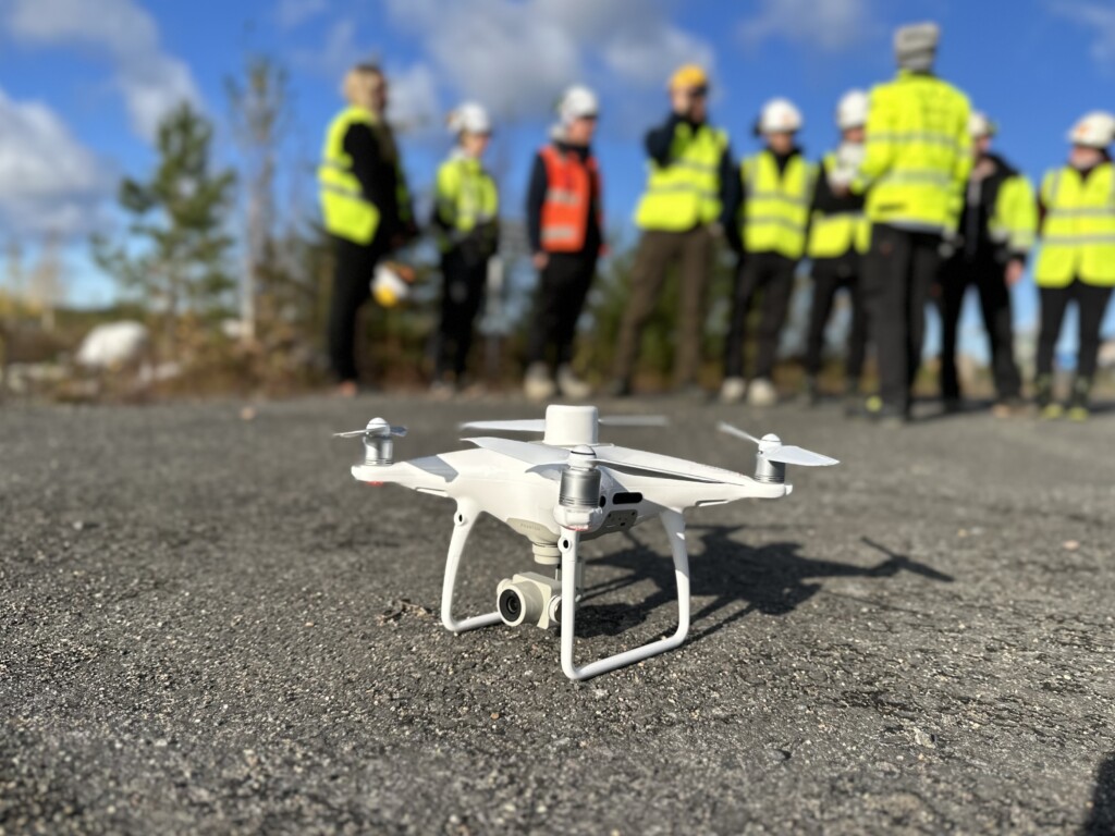
- Surveying Large Areas 🗺: Drones are ideal for surveying vast expanses like quarries or highways. They can cover significant ground quickly, making them a time-efficient choice.
- Cost-Effective 💰: Compared to laser scanners, drones (with cameras) are often more affordable to purchase and operate. They provide significant savings in time, especially when flying over larger areas.
- Versatile Data Collection 🛠: Drone captures can be used to calculate different types of data from one flight, including point clouds, but also orthophotos and surface models. Depending on the drone, even thermal cameras and small laser scanners can be used to produce thermal orthophotos or measured point clouds. This approach offers a comprehensive view of the surveyed area.
- Resolution Considerations 📐: When millimeter-level resolution is not required, drones provide a suitable and efficient solution.
However, drones might not be suitable for all scenarios. For example, flying drones in tunnels or indoors can be challenging if impossible, and they might not provide the accuracy needed for specific tasks like rail geometry analysis.
Drones can collect data with a laser scanner attached to the drone (as payload) or use only the camera on the drone to capture photos. The captured photos are processed with photogrammetry software1 to create a point cloud and other map datasets. Using an RTK2 drone and GCPs3 will increase the accuracy of the drone-collected data.
Laser Scanners: Precision and Flexibility 🔭
Laser scanners offer a different set of advantages, particularly when precision and indoor capabilities are required:
- High Accuracy 💯: Laser scanners provide exact measurements, making them the go-to choice when higher accuracy is needed. They are particularly useful for mapping intricate details.
- Indoor and Tunnel Use 🏠: Unlike drones, laser scanners (tripod or mobile) can be used indoors and in tunnels. They capture every corner and crack, providing a detailed view of the interior spaces.
- Weather Resilience 🌦: Laser scanners don’t require the same kind of good weather as drones. They can be used even when it’s windy or the weather is less than ideal.
- Safety Considerations 🦺: Laser scanners don’t pose the same risks as drones, as they won’t fall out of the sky or crash into obstacles. They offer a safer alternative in populated or constrained environments.
However, laser scanners might not be suitable for all scenarios. For example, mapping large areas is time-consuming and produces a large dataset. Laser scanner data needs to be processed, cleaned, and classified to be used properly, as they produce more noise than when using photogrammetric processing. Setting up the tripod in the middle of a busy construction site might be a safety hazard or an obstacle for other workers.
The most common way to use laser scanners is to set them up on a tripod. There are also hand-held or ‘backpack’ laser scanners that use SLAM4 for positioning. A fast, yet more expensive way to cover larger areas, is mobile laser scanners (e.g. on cars). Laser scanners can also be attached to drones and robots like the Spot.
Conclusion
Choosing between drones and laser scanners depends on the specific needs of your project. Drones offer speed and cost-effectiveness for large outdoor areas, while laser scanners provide precision and flexibility for indoor or detailed mapping.
Understanding the benefits and applications of both tools allows professionals to make informed decisions, optimizing efficiency, accuracy, and safety. Whether you’re mapping a sprawling quarry or a complex tunnel system, the right tool can make all the difference.
Next Steps
What to do with the data once it is collected? The data amounts might get quite big and it is time-consuming to share the data with others. Your colleagues might not have the needed software to handle the data.
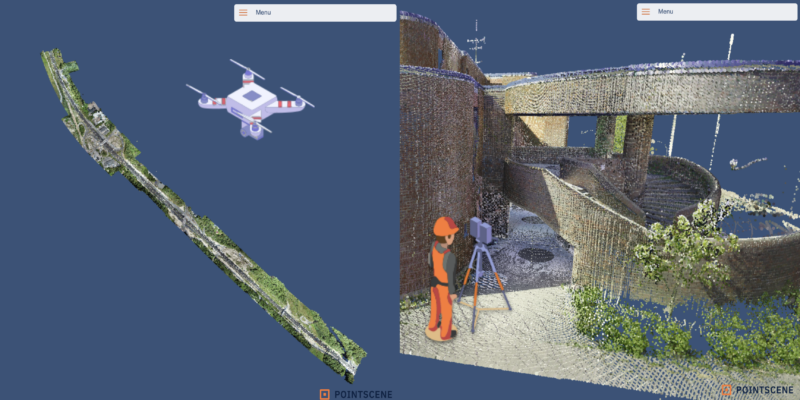
Pointscene can help you with managing your point clouds. Upload once to Pointscene, share to different software, and create and share open and free 3D viewers with data like this one.
Learn more about sharing point clouds:
Have a chat with us:
- Photogrammetric software = software that uses photogrammetric processing to create a 3D model using photos. Examples: Pix4D, DroneDeploy, Agisoft,…
- RTK = Real-time Kinematic = The photos or point cloud collected with an RTK drone are more accurate than using only GPS. RTK operates by using a single base station receiver and one or more mobile units. The base station receiver, which is fixed at a known location, continuously broadcasts the difference between its known fixed position and the position calculated using the satellite signals. The RTK-equipped drone receives the satellite signals and the correction signal from the base station. By comparing the two, it can correct its position with a high degree of accuracy.
- GCP = Ground control points = A GCP is a visible mark on the mapped area. Typically the drone pilot draws a cross with spray paint on the ground and measures its location with e.g., an RTK GPS receiver. The recorded points are used in the photogrammetric processing to correct the location of the point cloud and other map datasets.
- SLAM = Simultaneous Localization And Mapping = With SLAM, a device can figure out where it is (localize) and build a map of its surroundings simultaneously (mapping).