
(Est. read time: 5 min) The original article and similar content can be found on our homepage here.
Open-pit mining and quarrying are among the most data-driven sectors in infrastructure and raw material production. Yet, gaps between design, daily operations, and actual site conditions often lead to delays, safety risks, and inefficiencies.
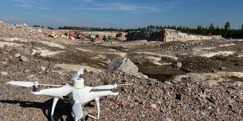
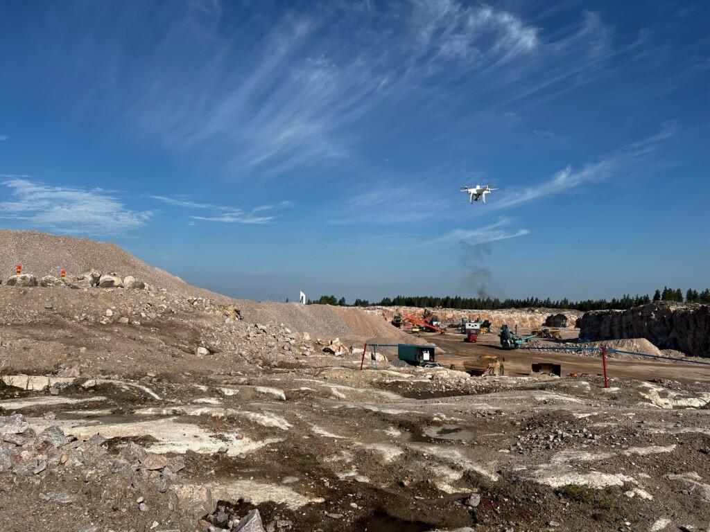
Reality data that is captured using drones, terrestrial scanners, or mobile mapping helps bridge this gap.
With increasing pressure to optimise production, monitor safety zones, and maintain compliance, mining operators are turning more and more to reality capture tools and platforms like Pointscene to bring clarity to rapidly changing environments.
Why Reality Data Matters in Open-Pit and Quarry Projects
Open-pit and quarry sites are dynamic by nature and are constantly reshaped by blasting, excavation, backfilling, and adjustments to haul roads. Traditional surveying methods often struggle to keep up with the pace, leaving teams to make decisions based on outdated or incomplete information.
By using drone photogrammetry and Lidar, teams can generate accurate surface models and elevation data, updating site information as often as needed —whether daily, weekly, or after each blast.
With up-to-date data, teams stay aligned with the real conditions on the ground.
3 Key Use Cases for Reality Data in Mining and Quarrying
1. Volume Calculations and Production Monitoring
Measuring how much material has been extracted, moved, or stockpiled is at the core of operations. Reality data enables teams to:
- Compare surfaces before and after blasting or excavation.
- Validate subcontractor outputs to prevent disputes.
- Calculate stockpile volumes automatically and track progress over time.
With Pointscene, these tasks become fast, visual, and accessible, with no need to wait for delayed reports or hand off raw data for specialized processing.
2. Design Compliance and Safety Management
Mine and quarry operators must meet strict geotechnical and safety standards. Reality data supports:
- Monitoring of bench heights, catch berms, and slope angles for stability.
- Verification of haul road gradients and widths for safe operations.
- Tracking of extraction boundaries to ensure environmental compliance.
By overlaying design plans with live surface models, site managers can identify deviations early and take corrective action before minor issues become costly problems.
3. Cross-Team Collaboration and Progress Communication
Mining and quarrying projects involve contractors, consultants, regulators, and field teams. Shared, up-to-date maps allow teams to:
- Discuss active zones, plan blasts, and review progress with a standard visual reference.
- Align quickly during site meetings, whether they are remote or in person.
- Reduce missed updates and email chains with a single, current model accessible to all stakeholders.
Reality data ensures that everyone is operating from the same understanding, whether you’re working with geology consultants, drone operators, or remote supervisors.
From Periodic Surveys to Continuous Site Awareness
Mine and quarry operations have traditionally relied on periodic surveys that are accurate but slow.
With reality capture integrated into platforms like Pointscene, teams move toward continuous site awareness, improving responsiveness and reducing uncertainty.
Key benefits include:
- Up to 50% faster volume reporting.
- Reduced reworks and safer operations.
- Increased transparency for regulators and stakeholders.
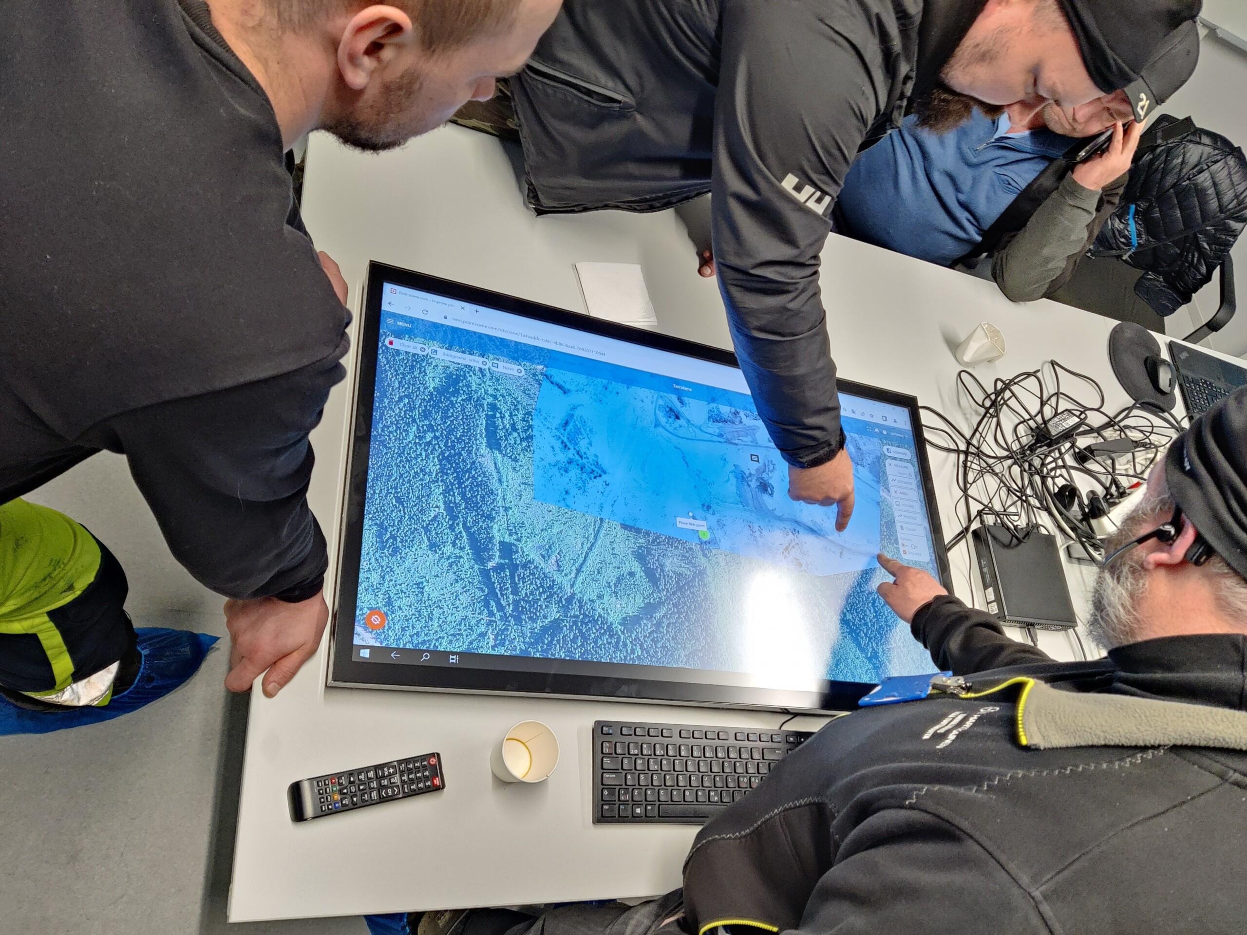
One of our client cases:
Terrafame Mine with E. Hartikainen Oy At the Terrafame mine in Finland, E. Hartikainen Oy uses Pointscene to monitor daily operations and manage production volumes more efficiently. By capturing drone data regularly and sharing up-to-date site models through Pointscene, the team ensures faster decision-making, better subcontractor validation, and smoother coordination across teams. With continuous surface updates, they have reduced the time needed for volume calculations and improved overall site awareness — without delays or uncertainty.
Read more about this project via the link or check out our client showcase below!
Ready to get started
See what Pointscene can do for your next project. Try it out for free or book a demo.
You can read more articles like this on our blog: Pointscene.com
Some of our top pics:
Revolutionizing Point Cloud Data Collection: Handheld iPhone Scanners with Enhanced GPS
Construction Site Mapping with Drones: RTK vs. Traditional Methods
Unlocking the Full Potential of Point Clouds: The Importance of Classification of Your Data