
Pointscene now supports WMS web services, single 360 images and sends an email when data processing is done in addition to some minor adjustments and bug fixes.
WMS web service support
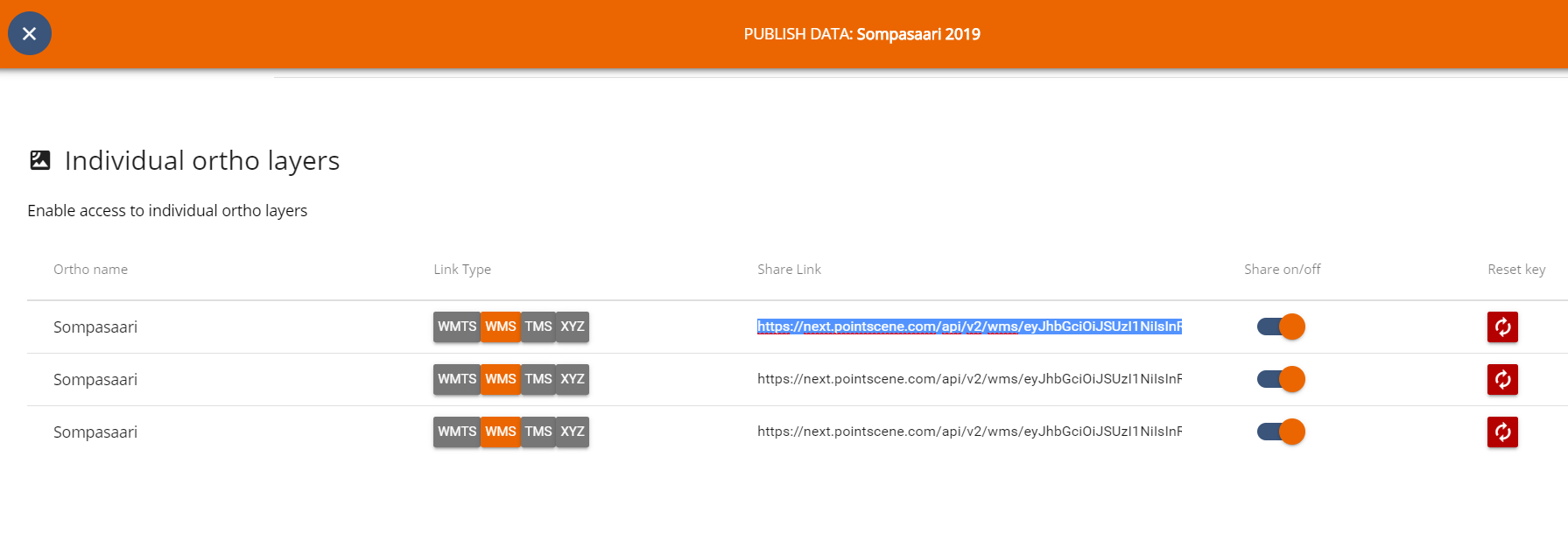
Pointscene now publishes WMS web services including all of your site’s ortho photos that have sharing set on. We also support custom EPSG codes.
Go to Instructions for more detail descriptions.
360 Images
Now you can upload and see individual 360 images to Pointscene in addition to the “street view” imagery data. The system recognizes the images as an individual when the timestamp between pictures is bigger than 30 seconds.
Email notification
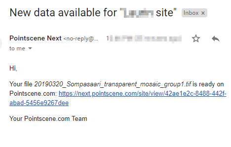
Once you upload a raster or point cloud, there is a processing time after the file is in our system. This processing time is depended on the data, so it varies between datasets. We added a feature, where the user gets an email when the data processing is done, so that you don’t need to wait and stick around and wonder when the processing is done. The email arrives from the address: no-reply@mg.pointscene.com.
Other Changes
We removed the option for Hillshade upload and changed the name of Ortho photo to “Aerial”.
This is the new option to choose when uploading ortho mosaic map data (drone 2D map).
The other option “Map” is only for raster map drawings, as it is semi-transparent and is not able to be published as WMTS etc. web services.