Pointscene license packages
All project licenses are offered on a construction project -basis with continuous subscriptions or annual agreements. All packages have unlimited amount of users per site. For all Pointscene licenses, we provide a full 30-day guarantee period, no further questions asked! Storage soft limit is 1TB / project for most license types. Additional storage space can be scaled as needed.
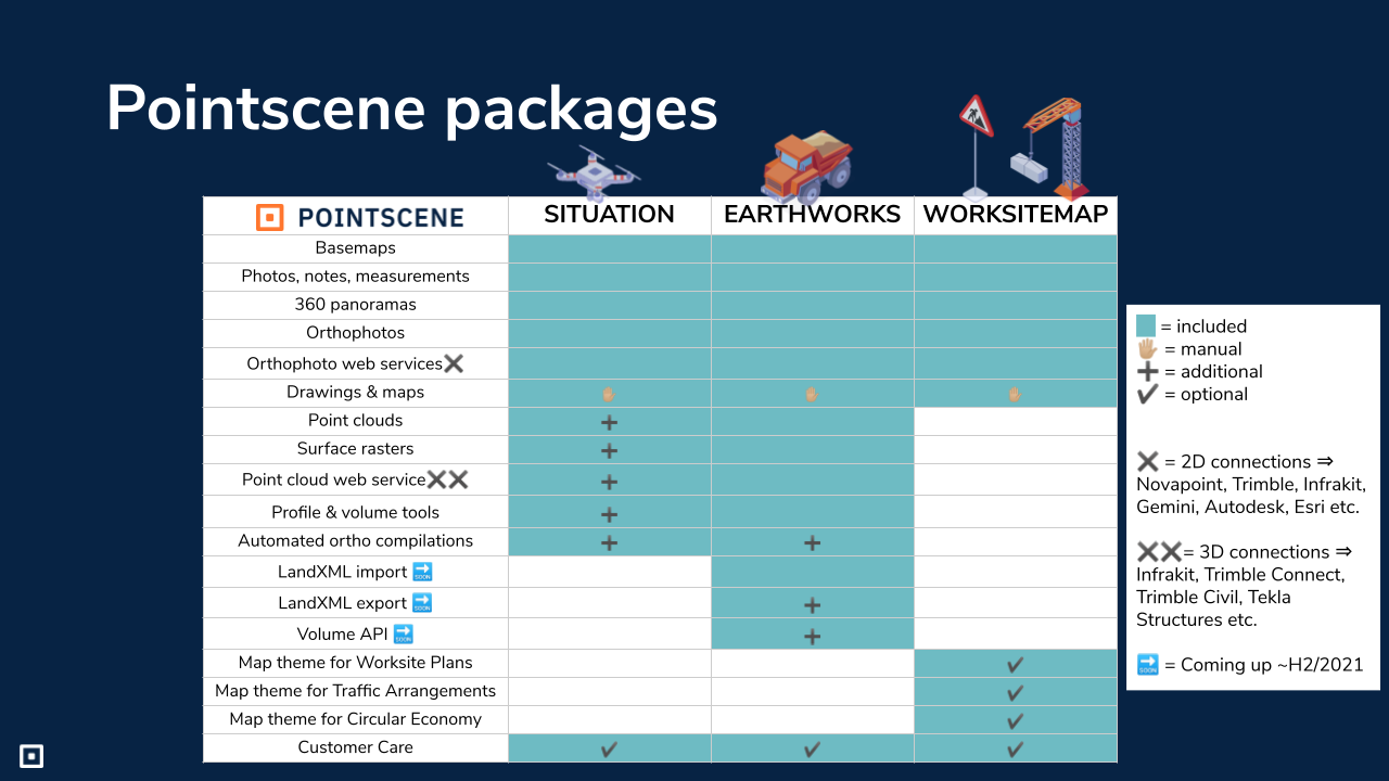
Pointscene Situation
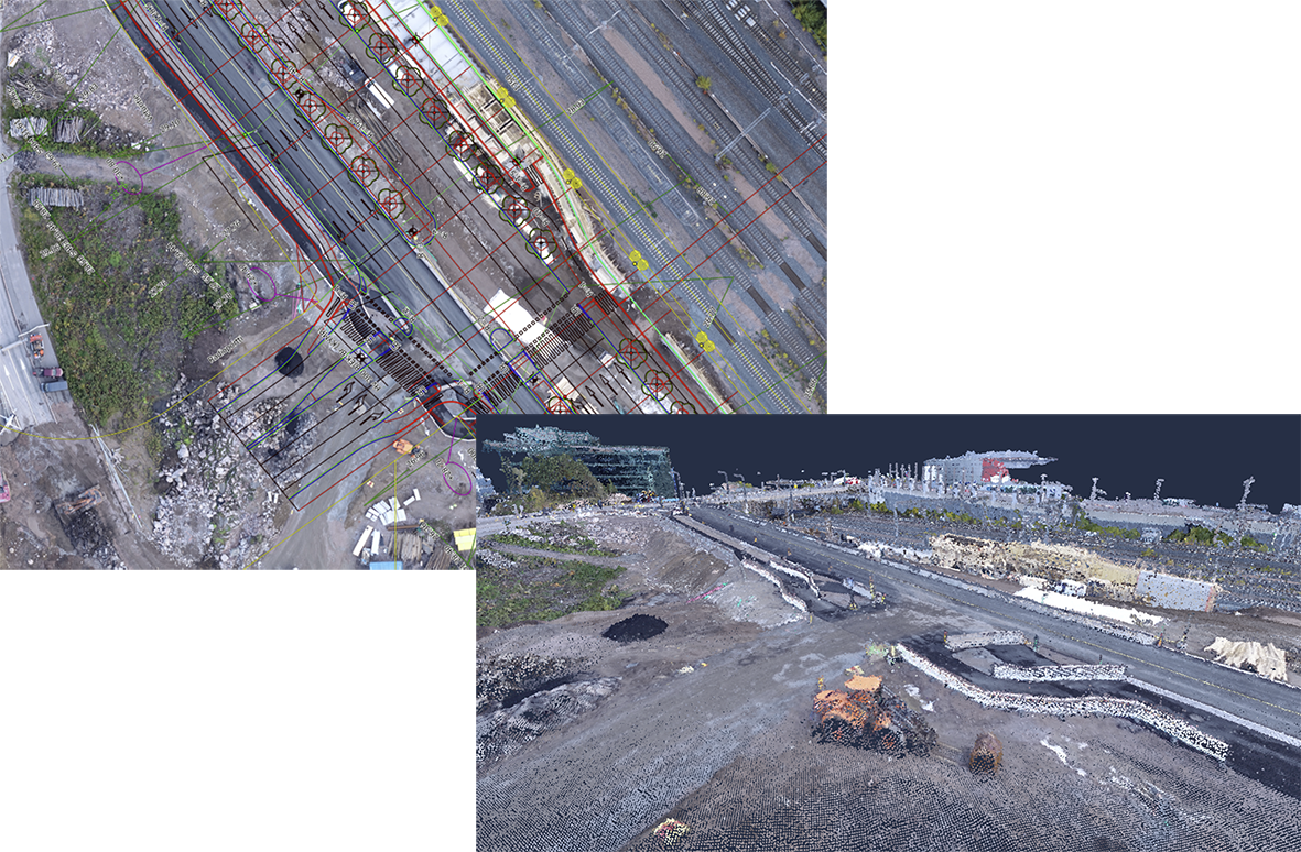
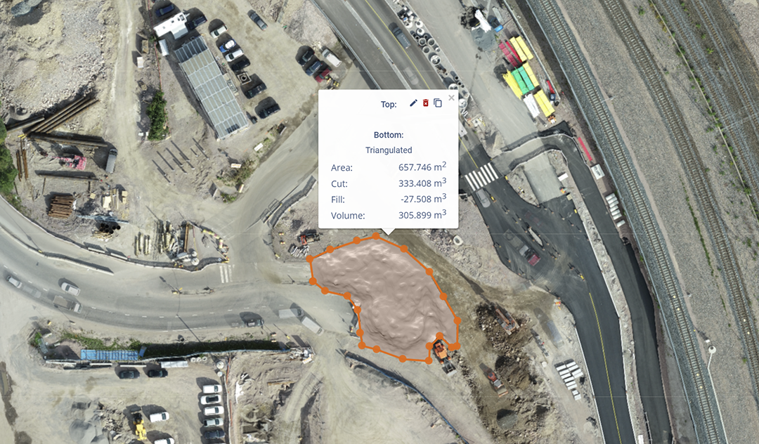
Take control of your worksite using your drone or laser scanning data! Share your data to every participant via share links and compare your different datasets using compare tool. Calculate volumes and share up to date orthophotos using the compilation link (Situation+).
- For situation data management (images, 360 captures and orthos’ features, typically in 2D)
-
- Add WMS-layers and design files (tiff) to your site
- Including CAD/BIM/GIS connections in 2D via web services
- For example Infrakit, 3DWin, Geo, Novapoint & Gemini Terrain
-
Situation+
- With automated ortho compilations
-
- With point clouds and surface/volume features
- Point cloud web services to Trimble Connect, Tekla Civil, Tekla Structures & Infrakit etc.
- With point clouds and surface/volume features
-
Pointscene Earthworks
Take complete control of your worksite and get the most out of your drone and laser scanning data! Calculate quantities and volumes and compare them to your design & XML surfaces. Share your point clouds and up to date orthophotos using the compilation link (Earthworks+).
- for earthworks’ progress monitoring and quantity takeoff
-
- Including point clouds and surface/volume features
- Add WMS-layers and design files (tiff) to your site
- Manage images, 360 captures and orthophotos
- Including 2D CAD/BIM/GIS connections and point clouds via web services
- LandXML design surface import (available Q4/2021)
-
Earthworks+
-
-
- With automated ortho compilations (for large projects)
- LandXML design surface import/export (available ~Q4/2021)
- Available also via API/web service
-
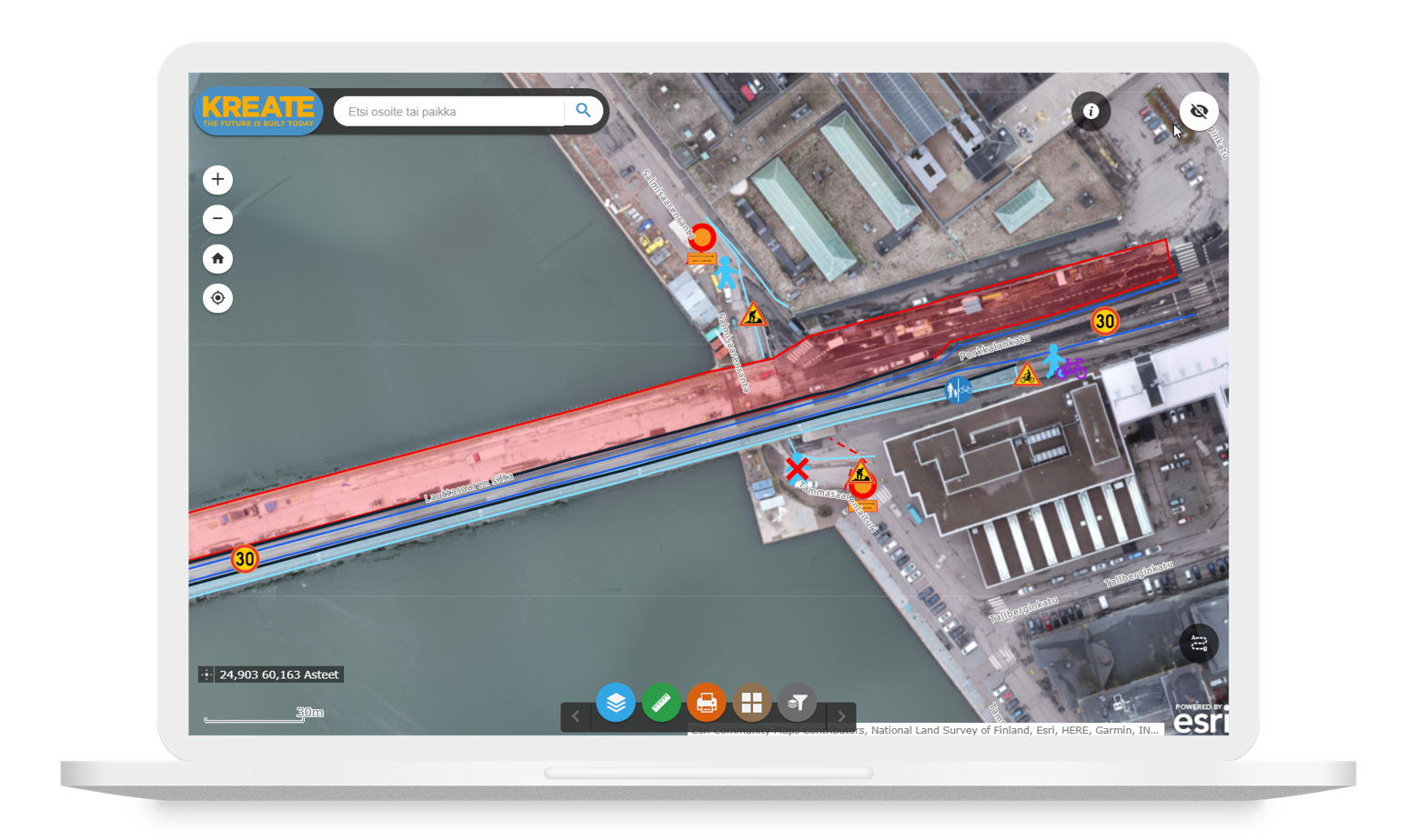
Pointscene Worksitemap
Create easy to use and understand worksitemap for your site and publish it! Design detours for traffic and pedestrians and optimize the use of your site area.
- for planning and communicating of traffic and worksite arrangements.
- Interactive web map applications running on Pointscene data
- Readily available map themes, with customer-specific setups:
-
- Traffic arrangements
- Site arrangements
- Circular economy sites
-
- Available upon separate request