About the project
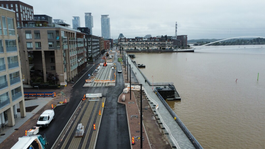
The Kalasatama-Pasila Project is a new 4.5 km tramway from Kalasatama to Pasila. With a focus on sustainability, accessibility and efficiency, this project is set to redefine the way residents commute, bridging key areas of the city and promoting eco-friendly modes of transport.
Read more about the project: https://www.kalasatamastapasilaan.fi/
Project Statistics
- 4.5km of tram line
- Construction: 2021-2024
- 80 M€ budget for the main project (200 M€ for related projects around the tram line)
- Project client: City of Helsinki & Kaupunkiliikenne Oy
- 2 Alliences: Sörkän spora and Karaatti.
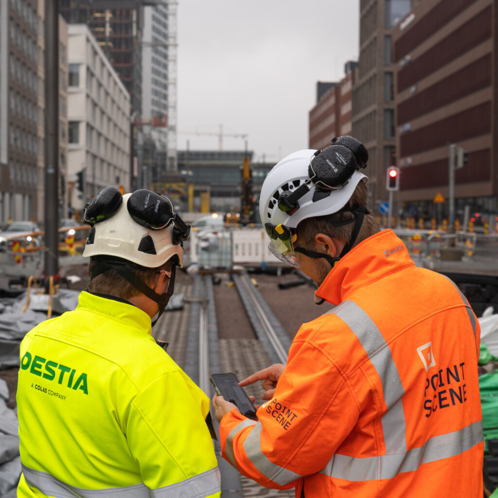
- Sörkan spora alliance: Destia Oy, Destia Rail Oy, Sweco Finland Oy & WSP Finland Oy
- Karaatti alliance: GRK Suomi Oy ja AFRY Finland Oy
- Destia Oy and GRK Suomi Oy use Pointscene on this project
Currently Kalasatama is home to around 9,000 residents but it’s projected to accommodate over 25,000 residents and more than 10,000 workplaces by its completion.
Goals
The project is a pilot for increasing sustainability and circular economy. To comply with the project’s ambitious sustainability goals, the project needs to be carried out with a high digitalization level and streamlined open BIM processes. The sustainability targets can be measured and evaluated accordingly with continuous monitoring and documentation of the construction work.
The Kalasatama-Pasila project pays special attention to decreasing life cycle effects, promoting a circular economy, mitigating the adverse effects of construction sites, and enhancing the stakeholders’ chances to participate. They also aim for explicit and open communications that reach all their target audiences.
Solution
Using Open BIM & GIS Standards:
The Kalasatama-Pasila project integrated Open BIM & GIS standards into their way of working. Both alliances use drones to document the current status of the work site. They both use the same Pointscene project (only one Project license for the entire project!) to store and share their orthophotos with all stakeholders. They use Pointscene’s automatic ortho-sharing tools. This approach reduced the number of file transfers, making the process more time-efficient. Additionally by adopting open web map standards (WMS) for the drone data collected designers had direct access to the latest aerial images within their design tools, eliminating the need for transferring large files.