
(Est. read time: 6 min) The original article and similar content can be found on our homepage here.
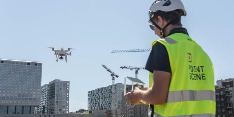
Using drones on construction sites is no longer just an innovation. It has become the standard. From orthophotos and point clouds to 3D models and LiDAR, drones make documenting what is happening on the ground faster, safer, and more affordable.
But the real power of drone data comes when you start sharing it. When your entire project team has access to the same up-to-date site view, you reduce miscommunication, avoid delays, and stay ahead of potential problems.
Why shared drone data matters
Drone data is often underutilised because it is scattered across various folders or is accessible only to a limited number of team members. However, when this data is easily accessible to everyone involved in the project, including owners, designers, contractors, surveyors, and regulators, it becomes a valuable tool that enhances collaboration among the entire team.
Better oversight for project owners and developers
If you manage a project, staying on top of progress is easier when you have a clear and current view of the site. With shared drone data, you can follow updates without constantly being on location. Supports faster reporting, improves transparency, and reduces surprises during reviews or audits.
Design based on real conditions
If you are part of the design or engineering team, you know how crucial accurate site data is. Shared drone data helps you work with the most current terrain and conditions. When connected with your design tools, it allows you to spot conflicts early and make informed planning decisions based on what is actually happening on-site.
Smoother day-to-day work for construction teams
Access to aerial views of the site helps your team plan material deliveries, equipment use, and daily workflows more efficiently. Shared drone data also supports better safety practices by helping you identify hazards or changes on site. Regular updates allow you to track progress in near real-time and react quickly when needed.
More accuracy and less rework for surveyors
If you are handling surveying or geospatial data, drone imagery and LiDAR help you work faster and with greater precision. Shared access ensures that everyone is using the same reliable data. There is no need for repeated site visits or version confusion. And when your drone data connects with GIS, the workflow from capture to analysis becomes much more efficient.
A clearer view for regulators and the public
Keeping stakeholders informed is easier when you can share visual updates of the site. Regulators benefit from clear documentation that supports compliance checks and reviews. Local communities can see how the project is progressing and understand what is being built. This helps build trust and improves communication throughout the process.

How Pointscene helps you manage and share drone data
Capturing drone data is only the first step. The real challenge is ensuring everyone on your team can access and use that data easily, no matter what tools they rely on.
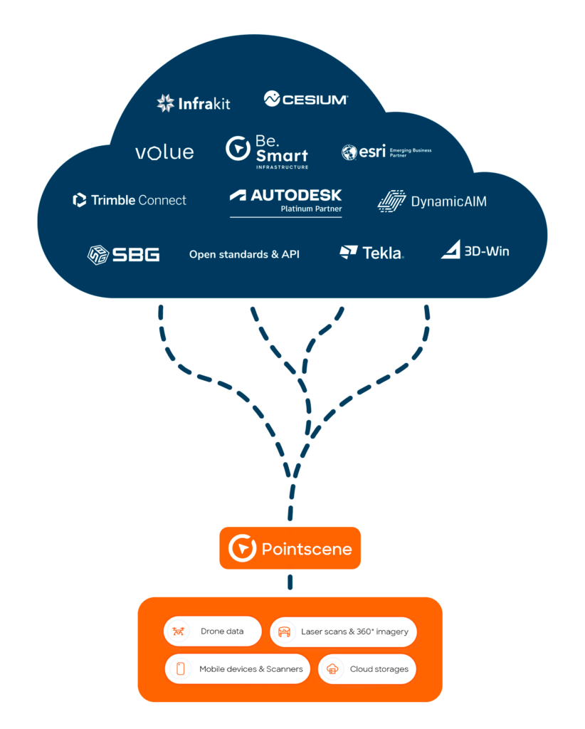
Pointscene gives you a centralised platform where you can store, manage, and share all your drone imagery, point clouds, and 3D models. Everything is securely stored in the cloud and available to your team whenever needed. With automatic updates and precise version control, you can be confident that everyone is working with the most current information.
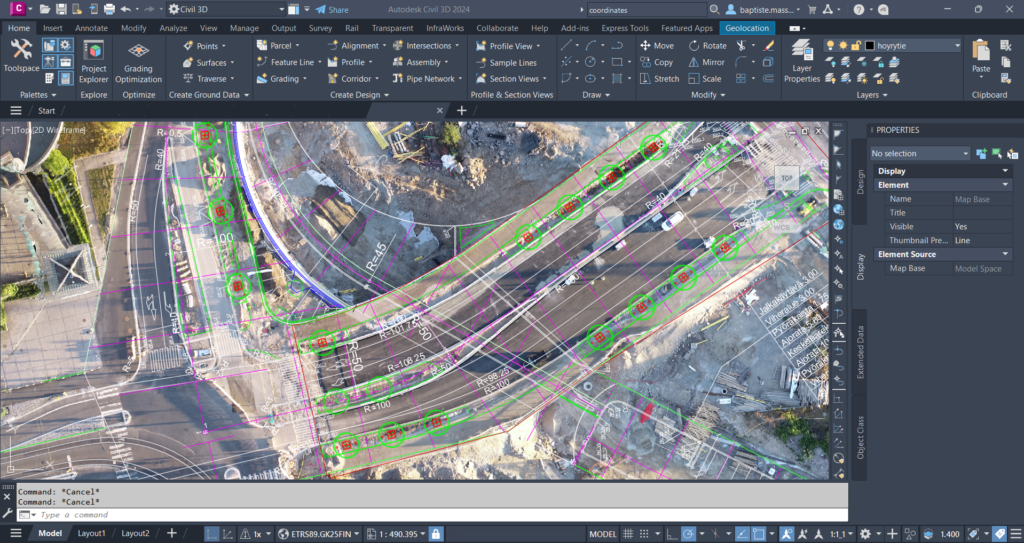
Pointscene is designed to work seamlessly with the software you already utilise. Whether your team uses Autodesk Civil 3D, Trimble, InfraWorks, QGIS, or other planning and design tools, Pointscene supports easy data export and integration. Allowing you to incorporate drone-based reality data into your existing workflows without additional steps or manual conversion. You can automate routine processes such as orthophoto generation and surface model updates, ensuring that the latest data is always accessible for planning, design, and reporting. From weekly construction site monitoring to long-term infrastructure development, Pointscene links your field data to your office tools, keeping everyone informed and aligned.
Whether you are tracking progress, reviewing changes, or preparing for a meeting, you can find the correct data quickly and use it with confidence. And because everything is connected, you spend less time moving files and more time making decisions.
Learn more about the supported software and integrations at pointscene.com/connect-and-control
Shared data helps you work smarter
When timing, communication, and accuracy matter, shared drone data gives your team a real advantage. It helps you reduce mistakes, improve collaboration, and keep your project on track.
With Pointscene, you get a reliable and easy way to turn drone data into a shared resource for your entire team. Whether you are managing a small site or a large infrastructure project, you can access the latest aerial data, stay aligned across teams, and make faster, better decisions.
Everything connects to the tools you already use, so there is no need to change how you work. You save time, avoid confusion, and stay in control of your site data.
Ready to get started
See what Pointscene can do for your next project. Try it out for free or book a demo.
You can read more articles like this on our blog: Pointscene.com
Some of our top pics:
Revolutionizing Point Cloud Data Collection: Handheld iPhone Scanners with Enhanced GPS
Construction Site Mapping with Drones: RTK vs. Traditional Methods
Unlocking the Full Potential of Point Clouds: The Importance of Classification of Your Data