
The construction industry is embracing digital transformation, with reality capture technology playing a key role in improving efficiency, accuracy, and collaboration. But collecting high-quality geospatial data is just the beginning. How you manage and share it determines its real value**. Pointscene ensures construction teams can seamlessly handle reality capture data, turning insights into action.
What is Reality Capture Data?
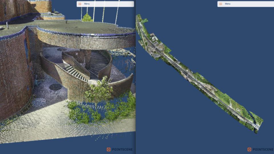
Reality capture digitally documents physical environments using drones, laser scanners, LiDAR, and photogrammetry. This data generates 3D models, orthophotos, and point clouds, offering a precise representation of job sites for planning, monitoring, and analysis.
The Challenges of Managing Reality Capture Data
Reality capture data plays a crucial role in modern construction and infrastructure projects, but efficiently managing and sharing this data presents several challenges. High-resolution scans and imagery generate massive file sizes that demand significant storage capacity and processing power. Teams often work in isolation without a centralised platform, leading to fragmented and inconsistent datasets. A lack of standardisation across various file formats and software solutions also creates barriers to seamless integration into existing workflows. These factors combined make accessibility a key issue, as stakeholders frequently struggle to retrieve and use the most up-to-date information effectively.
These challenges can slow down workflows, create inefficiencies, and lead to costly mistakes. However, with Pointscene, reality capture data becomes an asset rather than a hurdle.
The Power of Shared Reality Capture Data
With Pointscene, managing and sharing reality capture data becomes effortless. This leads to tangible benefits:
🔸 Smarter Decisions – Real-time access to accurate site data reduces errors and rework.
🔸 Better Collaboration – Teams work with up-to-date information, improving coordination.
🔸 Faster Project Timelines – Eliminating data bottlenecks helps keep schedules on track.
🔸 Stronger Compliance – A digital site record simplifies audits and legal documentation.
Supporting Infrastructure Designers with Reality Capture
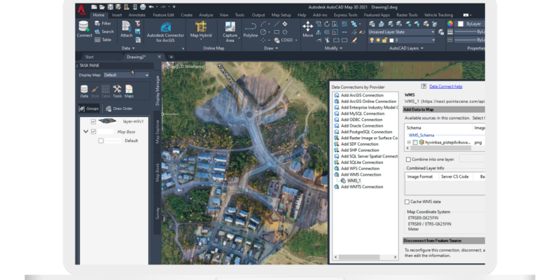
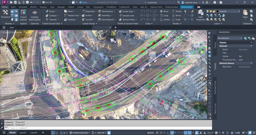
Infrastructure designers rely on reality capture data to ensure their plans align with actual site conditions, from underground utilities to terrain variations. By integrating point clouds and 3D models into BIM and CAD workflows, they can identify conflicts early and reduce costly design iterations. With accurate, real-world visualizations, engineers and project managers can collaborate seamlessly, ensuring that planned infrastructure elements fit within existing environments. This streamlined approach enhances constructability, minimizes rework, and keeps projects on track.
How Pointscene Simplifies Reality Capture Data Management
Pointscene provides a centralized, user-friendly solution to handle reality capture workflows:
🔸 Cloud-Based Data Storage & Access. Keep all project stakeholders aligned with a single source of truth.
🔸 Seamless Data Sharing. Share point clouds, 3D models, and orthophotos effortlessly.
🔸 Optimized Data Processing & Integration. Convert and standardize files for BIM, GIS, and construction platforms.
🔸 Advanced Visualization & Analysis. Track progress, compare design to reality, and detect changes over time.
Unlock the Full Potential of Reality Capture Data
Reality capture is transforming construction, but its value depends on how well you manage and share the data. Pointscene helps you streamline workflows, improve collaboration, and drive project success.
Start making reality capture data work for you with Pointscene.
Some of our top pics:
Revolutionizing Point Cloud Data Collection: Handheld iPhone Scanners with Enhanced GPS
Construction Site Mapping with Drones: RTK vs. Traditional Methods
Unlocking the Full Potential of Point Clouds: The Importance of Classification of Your Data