
(Est. read time: 6 min)
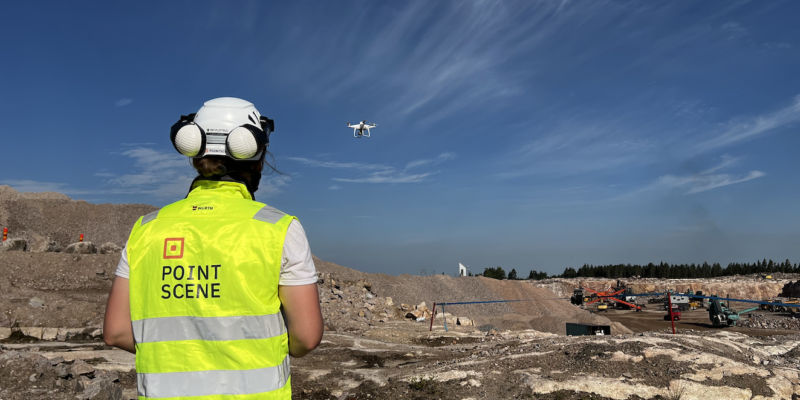
Rural highway projects are a tremendous challenge for BIM and construction managers. The complexities (like long duration, wide areas, constant change, and hidden geotechnical conditions) make it extremely difficult to stay up on the current state of work, and ensure positive financial results.
Lately, you’ve heard that reality data can improve rural highway work, and you’d like to implement a reality capture process on your own project. But there’s too much information out there — how do you get started?
This guide will offer everything you need to know. Below you’ll find a quick reference from industry experts that explains:
- 🌍 What kind of data to capture at each stage of your project
- 👍 What makes good data
- 👷♀️ How to use that data to do your job better
Jump to a specific phase
- Design Phase
- Planning Phase
- Preparation Phase
- Soil, Mid-layer, and Sub-base Removal Phase
- Construction Phase
- As-built Capture Phase
!!! Important note !!!
Regarding questions of accuracy, please refer to local guidelines, official resources, and client agreements. Since accuracy requirements will depend on a variety of circumstances that vary according to region and project, we won’t offer any specific guidance on accuracy below.
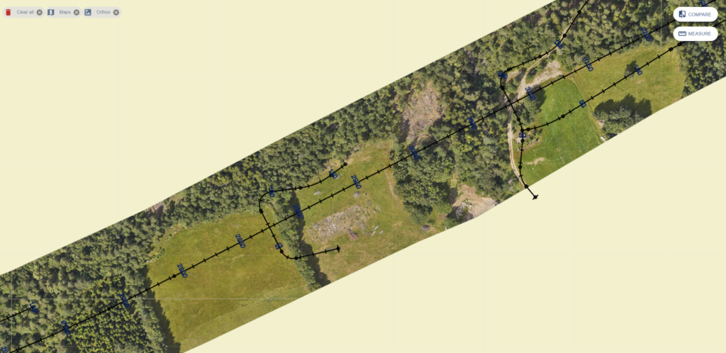
Quick guide for data capturing recommendations
X = Recommended options, O = Optional, for higher quality.
| Phase | Drone data | Aerial lidar scans | Terrestrial lidar | Mobile lidar |
| Design | X | |||
| Planning | X | O | O | O |
| Preparation | X | O | O | O |
| Removal | X | |||
| Construction | X | X | ||
| As-built | X | X |
Design phase
Design work begins at the early stages of the project, and continues throughout construction as the situation on site changes. Up-to-date reality data can offer a view of current conditions, which is crucial to keep the design process running smoothly.
🌍 Capture this data
- Drone lidar
OR - Manned aerial lidar scans
👍 What makes good data
Focus on getting all the data necessary for design work. Pay attention to:
- Ground visibility
- Use a scanning technology that is fit for purpose. (That means, for instance, ensuring your scanning technician is using a tool that offers canopy “penetration.”)
- Coverage
- Include neighboring real estate, roads, parcels, overground utilities, fences, ditches, etc.
- Cover a wide enough area to accommodate future phases as the project expands
- Leave enough room for modifications (sometimes you will adjust boundaries of worksite as work continues–for instance, to widen banks.)
👷♀️ How to use the data
Once captured, use the data to produce all the models and calculations necessary for the initial project design.
- Generate baseline topographic models
- Determine real-world site context so that design work always has an accurate starting point.
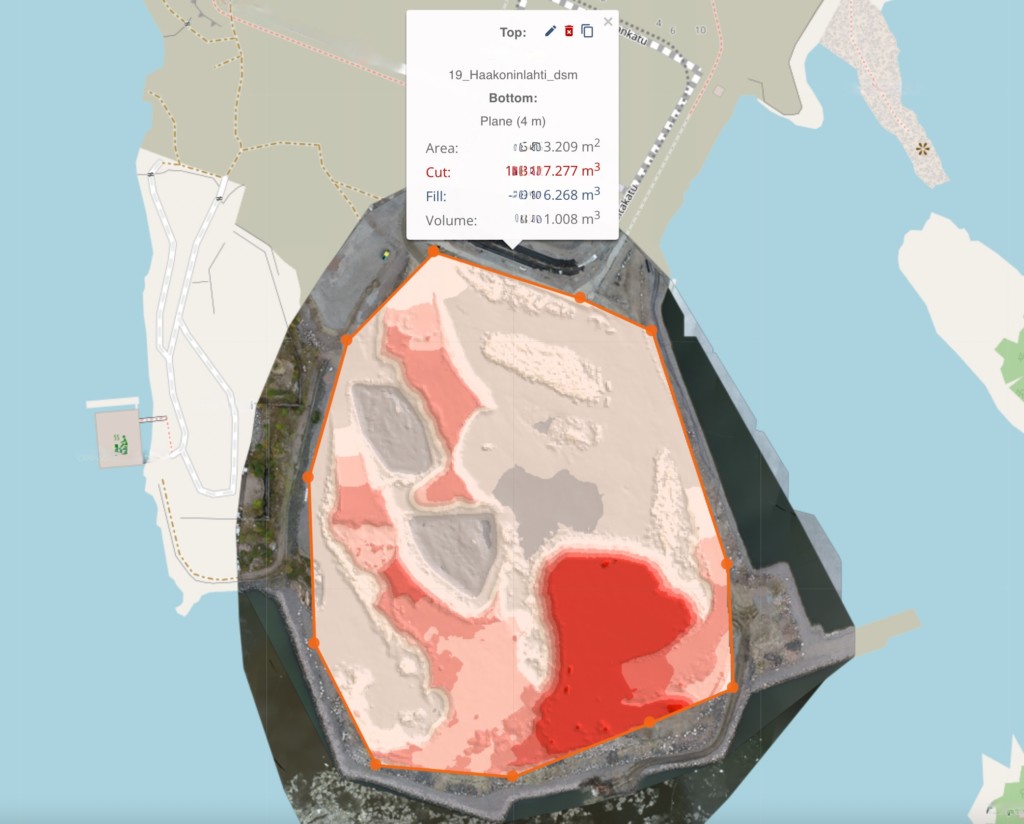
- Calculate earthworks quantities/masses
- Make more precise estimates for materials, and reduce extra costs.
- Combine topographic models with geotechnical surveys
- Such as boring and drilling, to give a full picture of on-site circumstances for design.
Jump to a specific phase
- Design Phase
- Planning Phase
- Preparation Phase
- Soil, Mid-layer, and Sub-base Removal Phase
- Construction Phase
- As-built Capture Phase
Planning Phase
Once the design models are complete, the project plans construction. In this phase, reality capture offers the data needed to analyze the site for surface conditions, material levels, and so on.
🌍 Capture this data
- Drone surface models
- orthophotos
- lidar point clouds
OR - photogrammetric point clouds
👍 What makes good data
Your reality captures should document any changes that have occurred between the design stage and construction planning. Pay attention to:
- Recency
- Many years might have passed since the project began, so it is likely that circumstances have changed—for instance, maybe a residential development has been built nearby.
- Don’t assume that a data set is up-to-date. Verify.
👷♀️ How to use the data
Update your project assets, including designs, estimates, client agreements, and more.
- Generate 2D cross-sections
- Perform coarse measurements
- Analyze whether predicted levels are correct
- Produce any paper documentation as required by your project agreement
- Generate triangle meshes
- Make final cost estimates using detailed real-world data.
- Verify whether existing maps or models need to be updated.
- Plan area reservations to determine what space will be used by the project, and whether extra space is needed.
- Update client agreement.
- Coordinate the worksite by determining space requirements for
- machinery
- on-site offices
- etc.
- Produce new designs
- Modify existing models, as needed, to account for changes to on-site circumstances.
- Combine point cloud with design model
- Visualize the design in its real-world context.
- Determine the placement of temporary routes and roads.
Jump to a specific phase
- Design Phase
- Planning Phase
- Preparation Phase
- Soil, Mid-layer, and Sub-base Removal Phase
- Construction Phase
- As-built Capture Phase
Reality Data in the Preparation, Removal, and Construction Phases
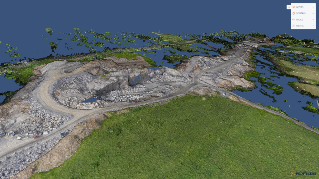
These construction phases are largely focused on moving large amounts of materials. Reality capture offers the data needed to track the volume of that material, where it goes, any costs associated with it, and more.
1. Preparation Phase
This portion of construction involves the removal of trees and topsoil and getting the site ready for work. Once the land is clear, reality data can be used to validate designs and plans.
🌍 Capture this data
- Drone surface models
- Lidar point clouds
OR - Photogrammetric point clouds
👍 What makes good data
Focus on capturing the “bare” site by focusing on:
- Coverage
- Include neighboring real estate, roads, parcels, overground utilities, fences, ditches, etc.
- Cover a wide enough area to accommodate future phases as the project expands
- Leave enough room for modifications.
- Recency
- Your data sets should clearly reflect all work completed to date, as well as any other changes to the site.
👷♀️ How to use the data
Use the data to revisit your original plans and estimates, and adjust as needed.
- Create baseline surface models
- View the actual surface of the terrain.
- Validate the real-world geotechnical conditions.
- Replace guesses based on point-to-point information.
- Determine geotechnical and mass balance values
- Determine if amounts differ from original estimates.
- Make correct cost estimates based on actual conditions.
- Rework budget with client.
2. Soil, Mid-layer, and Sub-base Removal Phase
As you remove layers, reality capture offers a way to track the materials being moved, determine true volume, and improve cost accounting with real-world data.
🌍 Capture this data
- Drone surface imagery and models
👍 What makes good data
Focus on capturing work as it is completed. Pay attention to:
- Capturing all progress
- Clearly document any changes to ensure correct material calculations.
- Strategic planning
- Most projects will not need to capture the entire work area in every capture—just the portions where a phase has been completed.
👷♀️ How to use the data
- Generate triangle meshes
- Track mass balance.
- Control and manage the stock available for each stage.
- Track material stock.
- Calculate the amount of outside materials for purchase (if needed).
- Document geotechnical state after each step
- Create records of each work stage for future validation.
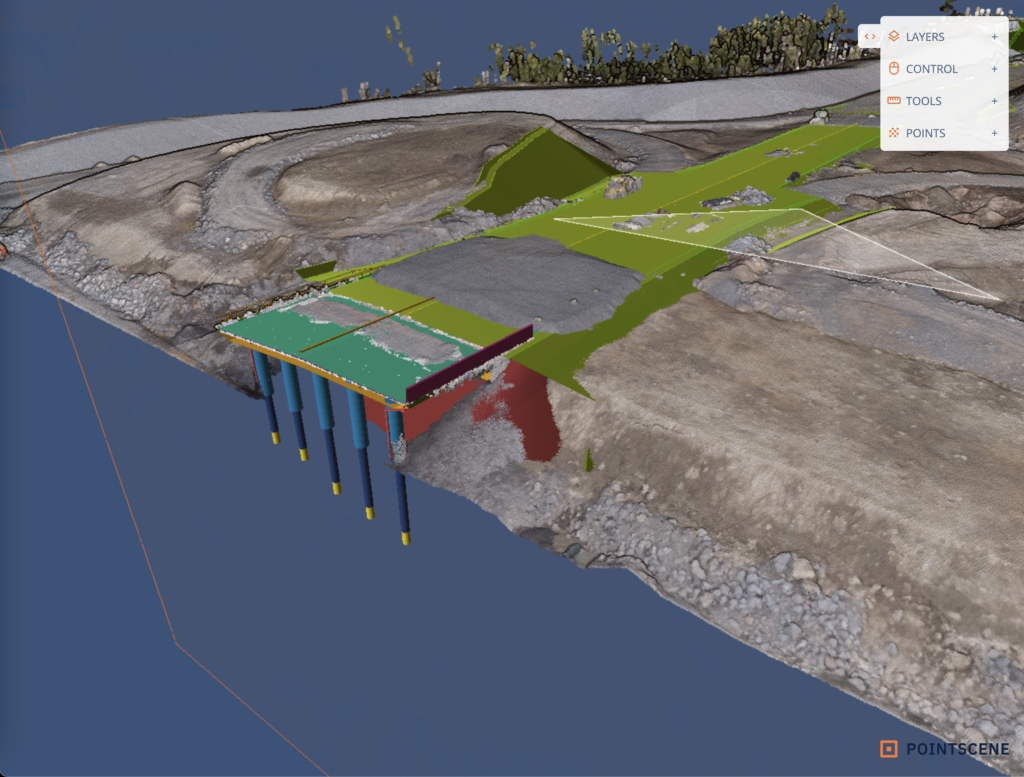
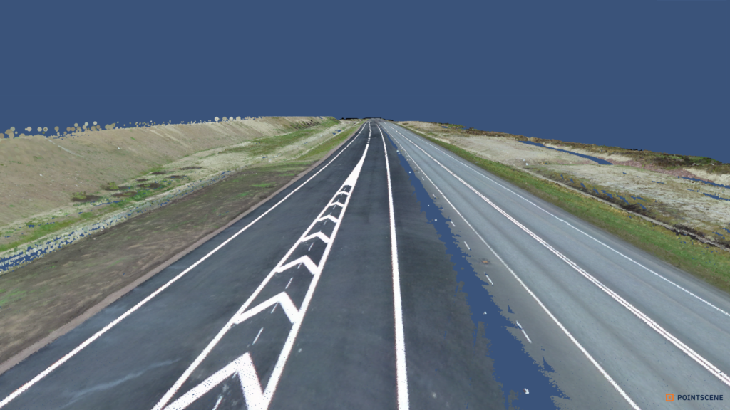
3. Construction Phase
As the project begins the actual construction work, more precise reality data—like point clouds captured by lidar—can offer detailed records for work as it is completed, as well as greater context about the terrain.
🌍 Capture this data
- Terrestrial lidar
OR - high-quality mobile lidar
👍 What makes good data
Focus on data that will help you evaluate the site’s readiness for construction, then record that construction as it happens. Pay attention to:
- Coverage
- Your data sets should clearly show the surfaces prepared for construction.
- Meaningful indicators of progress
- Your data sets should clearly document changes that reflect progress or new phases.
- Plan to capture each work phase as it is completed.
- Strategic planning
Most projects will not need to capture the entire work area in every capture—just the portions where a phase has been completed.
👷♀️ How to use the data
- Create triangle meshes
- Determine smoothness, slopes and grades.
- Evaluate site readiness for construction.
- Store point cloud and model for quality documentation at project delivery
Jump to a specific phase
- Design Phase
- Planning Phase
- Preparation Phase
- Soil, Mid-layer, and Sub-base Removal Phase
- Construction Phase
- As-built Capture Phase
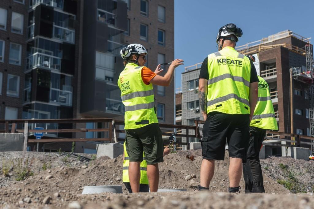
Reality Data in the As-built Capture Phase
Once surfaces and overground structures are constructed, reality data acts as a high-quality record of the project’s complete state, and a reference for future maintenance and potential QA disputes.
🌍 Capture this data
- High-quality mobile lidar point cloud
👍 What makes good data
Focus on gathering data that reflects the project as it was completed—as opposed to how it was originally designed.
Focus on:
- Full coverage of as-built (and “as delivered”) situation,
- Including data on roadside equipment, geometry of road, etc.
👷♀️ How to use the data
Converted to the appropriate deliverables for project completion.
- Produce necessary documentation
- Record road smoothness, slope, and grade.
- Set a proven baseline for future regular monitoring of sagging or depression of ground or road.
- Save data for potential quality disputes regarding bad enforcement or stabilization.